Area Overview for PR5 5RJ
Photos of PR5 5RJ
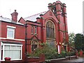

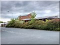
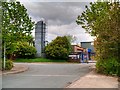
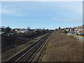
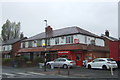
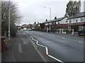
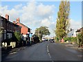

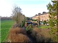
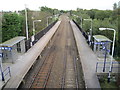
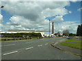
36 photos from this area
Area Information
Key information about the PR5 5RJ including its size, population, and administrative classification.
- Area Type
- Postcode
- Area Size
- 1.9 hectares
- Population
- 1252
- Population Density
- 5171 people/km²
House Prices in PR5 5RJ
42
Properties
£124,938
Average Sold Price
£43,000
Lowest Price
£250,000
Highest Price
Showing 42 properties
| Address | Type | Beds | Baths | Last Sale Price | Last Sale Date | |
|---|---|---|---|---|---|---|
| 33 St James Close, Lostock Hall, PR5 5RJ | Bungalow | 2 | 1 | £215,000 | Aug 2025 | |
| 29 St James Close, Lostock Hall, PR5 5RJ | Semi-detached | 2 | 1 | £145,000 | Mar 2025 | |
| 26 St James Close, Lostock Hall, PR5 5RJ | Semi-detached | 2 | 1 | £174,000 | Sep 2023 | |
| 22A St James Close, Lostock Hall, PR5 5RJ | Bungalow | 3 | 1 | £250,000 | Apr 2022 | |
| 11 St James Close, Lostock Hall, PR5 5RJ | Semi-detached | 3 | 1 | £164,000 | Feb 2020 | |
| 28 St James Close, Lostock Hall, PR5 5RJ | Semi-detached | 3 | 1 | £141,500 | Nov 2019 | |
| 13 St James Close, Lostock Hall, PR5 5RJ | Detached | 3 | 1 | £157,000 | Nov 2018 | |
| 39 St James Close, Lostock Hall, PR5 5RJ | Bungalow | 3 | 2 | £177,000 | Nov 2018 | |
| 9 St James Close, Lostock Hall, PR5 5RJ | Bungalow | 3 | 1 | £142,500 | Oct 2017 | |
| 21 St James Close, Lostock Hall, PR5 5RJ | Semi-detached | 2 | 1 | £123,000 | Aug 2016 |
Page 1 of 5
Energy Efficiency in PR5 5RJ
Amenities
Schools
| Rank | School | Type | Entry gender | Ages |
|---|
Explore more schools in this area
Go to Schools tabDemographics
Household Size
Two person
most common
Accommodation Type
Houses
most common
Tenure
79
majority
Ethnic Group
White
most common
Religion
N/A
most common
Household Composition
N/A
most common
Age
47
median
Adults (30-64 years)
most common
Household Deprivation
N/A
with no deprivation
NS-SEC
28
in Lower managerial occupations
Explore more demographic insights in this area
Go to Demographics tabPlanning
Planning Constraints
- Flood RiskPremium
- Ramsar Wetland SitesPremium
- Area of Outstanding Natural BeautyPremium
- Protected Nature ReservePremium
- Protected WoodlandPremium