Area Overview for PR5 4QA
Photos of PR5 4QA
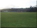
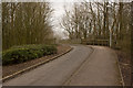
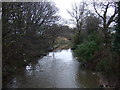
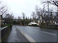
19 photos from this area
Area Information
Key information about the PR5 4QA including its size, population, and administrative classification.
- Area Type
- Postcode
- Area Size
- 1.5 hectares
- Population
- 1021
- Population Density
- 3067 people/km²
House Prices in PR5 4QA
33
Properties
£100,550
Average Sold Price
£43,000
Lowest Price
£163,000
Highest Price
Showing 33 properties
| Address | Type | Beds | Baths | Last Sale Price | Last Sale Date | |
|---|---|---|---|---|---|---|
| 13 Regent Road, Walton Le Dale, PR5 4QA | house | - | - | £158,000 | Sep 2024 | |
| 22 Regent Road, Walton Le Dale, PR5 4QA | Semi-detached | 2 | 1 | £155,000 | Oct 2023 | |
| 28 Regent Road, Walton Le Dale, PR5 4QA | Semi-detached | 2 | 1 | £155,000 | Nov 2022 | |
| 34 Regent Road, Walton Le Dale, PR5 4QA | house | - | - | £92,500 | Jan 2021 | |
| 9 Regent Road, Walton Le Dale, PR5 4QA | Semi-detached | 4 | 2 | £163,000 | Dec 2020 | |
| 2 Regent Road, Walton Le Dale, PR5 4QA | Semi-detached | 2 | 1 | £135,000 | Aug 2018 | |
| 7 Regent Road, Walton Le Dale, PR5 4QA | house | - | - | £128,000 | Jun 2018 | |
| 27 Regent Road, Walton Le Dale, PR5 4QA | Bungalow | 3 | - | £110,000 | Jul 2010 | |
| 26 Regent Road, Walton Le Dale, PR5 4QA | Bungalow | - | - | £111,000 | Feb 2008 | |
| 19 Regent Road, Walton Le Dale, PR5 4QA | Bungalow | - | - | £97,000 | May 2005 |
Page 1 of 4
Energy Efficiency in PR5 4QA
Amenities
Schools
| Rank | School | Type | Entry gender | Ages |
|---|
Explore more schools in this area
Go to Schools tabDemographics
Household Size
One person
most common
Accommodation Type
Houses
most common
Tenure
80
majority
Ethnic Group
White
most common
Religion
N/A
most common
Household Composition
N/A
most common
Age
47
median
Adults (30-64 years)
most common
Household Deprivation
N/A
with no deprivation
NS-SEC
31
in Lower managerial occupations
Explore more demographic insights in this area
Go to Demographics tabPlanning
Planning Constraints
- Flood RiskPremium
- Ramsar Wetland SitesPremium
- Area of Outstanding Natural BeautyPremium
- Protected Nature ReservePremium
- Protected WoodlandPremium