Area Overview for PR5 4PA
Photos of PR5 4PA
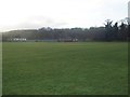
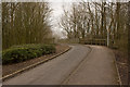
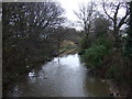
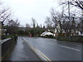
19 photos from this area
Area Information
Key information about the PR5 4PA including its size, population, and administrative classification.
- Area Type
- Postcode
- Area Size
- 1.2 hectares
- Population
- 1366
- Population Density
- 2744 people/km²
House Prices in PR5 4PA
29
Properties
£157,224
Average Sold Price
£58,250
Lowest Price
£260,000
Highest Price
Showing 29 properties
| Address | Type | Beds | Baths | Last Sale Price | Last Sale Date | |
|---|---|---|---|---|---|---|
| 146 Chorley Road, Walton Le Dale, PR5 4PA | Semi-detached | - | - | £90,000 | Apr 2025 | |
| 128 Chorley Road, Walton Le Dale, PR5 4PA | house | - | - | £260,000 | Oct 2021 | |
| 142 Chorley Road, Walton Le Dale, PR5 4PA | Semi-detached | 3 | 1 | £185,000 | Mar 2021 | |
| 118 Chorley Road, Walton Le Dale, PR5 4PA | Semi-detached | 3 | 1 | £205,500 | Aug 2020 | |
| 122 Chorley Road, Walton Le Dale, PR5 4PA | house | 3 | 1 | £174,000 | Jul 2019 | |
| 104 Chorley Road, Walton Le Dale, PR5 4PA | house | - | - | £135,000 | Jul 2017 | |
| 100 Chorley Road, Walton Le Dale, PR5 4PA | Semi-detached | 3 | - | £153,500 | Aug 2016 | |
| 124A Chorley Road, Walton Le Dale, PR5 4PA | Detached | 3 | 2 | £198,000 | Mar 2016 | |
| 134 Chorley Road, Walton Le Dale, PR5 4PA | house | - | - | £131,000 | Nov 2015 | |
| 102 Chorley Road, Walton Le Dale, PR5 4PA | Semi-detached | 3 | 1 | £168,500 | Jun 2012 |
Page 1 of 3
Energy Efficiency in PR5 4PA
Amenities
Schools
| Rank | School | Type | Entry gender | Ages |
|---|
Explore more schools in this area
Go to Schools tabDemographics
Household Size
Two person
most common
Accommodation Type
Houses
most common
Tenure
90
majority
Ethnic Group
White
most common
Religion
N/A
most common
Household Composition
N/A
most common
Age
47
median
Adults (30-64 years)
most common
Household Deprivation
N/A
with no deprivation
NS-SEC
33
in Lower managerial occupations
Explore more demographic insights in this area
Go to Demographics tabPlanning
Planning Constraints
- Flood RiskPremium
- Ramsar Wetland SitesPremium
- Area of Outstanding Natural BeautyPremium
- Protected Nature ReservePremium
- Protected WoodlandPremium