Area Overview for PR5 4JS
Photos of PR5 4JS


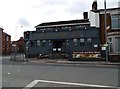
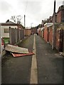

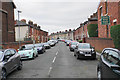

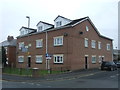
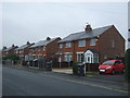
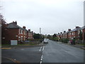
36 photos from this area
Area Information
Key information about the PR5 4JS including its size, population, and administrative classification.
- Area Type
- Postcode
- Area Size
- 1.2 hectares
- Population
- 2187
- Population Density
- 3767 people/km²
House Prices in PR5 4JS
27
Properties
£144,544
Average Sold Price
£31,800
Lowest Price
£250,000
Highest Price
Showing 27 properties
| Address | Type | Beds | Baths | Last Sale Price | Last Sale Date | |
|---|---|---|---|---|---|---|
| 177 Chorley Road, Walton Le Dale, PR5 4JS | Bungalow | 3 | 1 | £218,000 | Feb 2025 | |
| 199 Chorley Road, Walton Le Dale, PR5 4JS | Bungalow | 3 | 2 | £250,000 | Oct 2023 | |
| 187 Chorley Road, Walton Le Dale, PR5 4JS | house | - | - | £198,000 | Apr 2022 | |
| 217 Chorley Road, Walton Le Dale, PR5 4JS | Terraced | 3 | 1 | £177,000 | Aug 2021 | |
| 205 Chorley Road, Walton Le Dale, PR5 4JS | Semi-detached | 2 | 1 | £217,000 | May 2021 | |
| 209 Chorley Road, Walton Le Dale, PR5 4JS | Bungalow | 4 | 2 | £185,000 | Aug 2019 | |
| 219 Chorley Road, Walton Le Dale, PR5 4JS | Semi-detached | 2 | 1 | £145,000 | Jul 2018 | |
| Holland Slack Cottage, Chorley Road, Walton Le Dale, PR5 4JS | Semi-detached | 3 | 1 | £98,500 | Jan 2018 | |
| 211 Chorley Road, Walton Le Dale, PR5 4JS | Terraced | 3 | - | £145,000 | Jun 2015 | |
| 201 Chorley Road, Walton Le Dale, PR5 4JS | Bungalow | - | - | £182,000 | Feb 2014 |
Page 1 of 3
Energy Efficiency in PR5 4JS
Amenities
Schools
| Rank | School | Type | Entry gender | Ages |
|---|
Explore more schools in this area
Go to Schools tabDemographics
Household Size
Family (3-5 people)
most common
Accommodation Type
Houses
most common
Tenure
87
majority
Ethnic Group
White
most common
Religion
N/A
most common
Household Composition
N/A
most common
Age
47
median
Adults (30-64 years)
most common
Household Deprivation
N/A
with no deprivation
NS-SEC
41
in Lower managerial occupations
Explore more demographic insights in this area
Go to Demographics tabPlanning
Planning Constraints
- Flood RiskPremium
- Ramsar Wetland SitesPremium
- Area of Outstanding Natural BeautyPremium
- Protected Nature ReservePremium
- Protected WoodlandPremium