Area Overview for PR5 4ED
Photos of PR5 4ED


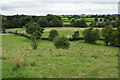
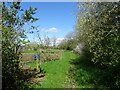

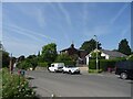
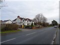
20 photos from this area
Area Information
Key information about the PR5 4ED including its size, population, and administrative classification.
- Area Type
- Postcode
- Area Size
- 5.5 hectares
- Population
- 1606
- Population Density
- 581 people/km²
House Prices in PR5 4ED
44
Properties
£153,009
Average Sold Price
£26,680
Lowest Price
£325,000
Highest Price
Showing 44 properties
| Address | Type | Beds | Baths | Last Sale Price | Last Sale Date | |
|---|---|---|---|---|---|---|
| 102 Hoghton Lane, Hoghton, Walton Le Dale, PR5 4ED | Terraced | 2 | 1 | £135,000 | May 2024 | |
| 96 Hoghton Lane, Hoghton, Walton Le Dale, PR5 4ED | house | - | - | £147,000 | Mar 2021 | |
| 93 Hoghton Lane, Hoghton, Walton Le Dale, PR5 4ED | Semi-detached | 2 | 1 | £155,000 | Oct 2019 | |
| 91 Hoghton Lane, Hoghton, Walton Le Dale, PR5 4ED | house | 4 | - | £308,000 | Oct 2019 | |
| 108 Hoghton Lane, Hoghton, Walton Le Dale, PR5 4ED | Detached | 3 | 2 | £200,000 | Jun 2019 | |
| Tree Tops, Hoghton Lane, Hoghton, Walton Le Dale, PR5 4ED | Semi-detached | 4 | - | £235,000 | Dec 2018 | |
| Westview, Hoghton Lane, Hoghton, Walton Le Dale, PR5 4ED | Semi-detached | 4 | 2 | £210,000 | Sep 2017 | |
| 97 Hoghton Lane, Hoghton, Walton Le Dale, PR5 4ED | house | - | - | £325,000 | Mar 2017 | |
| 100 Hoghton Lane, Hoghton, Walton Le Dale, PR5 4ED | Terraced | 2 | - | £122,000 | Aug 2016 | |
| 118 Hoghton Lane, Hoghton, Walton Le Dale, PR5 4ED | house | - | - | £126,000 | Sep 2015 |
Page 1 of 5
Energy Efficiency in PR5 4ED
Amenities
Schools
| Rank | School | Type | Entry gender | Ages |
|---|
Explore more schools in this area
Go to Schools tabDemographics
Household Size
Two person
most common
Accommodation Type
Houses
most common
Tenure
72
majority
Ethnic Group
White
most common
Religion
N/A
most common
Household Composition
N/A
most common
Age
47
median
Adults (30-64 years)
most common
Household Deprivation
N/A
with no deprivation
NS-SEC
32
in Lower managerial occupations
Explore more demographic insights in this area
Go to Demographics tabPlanning
Planning Constraints
- Flood RiskPremium
- Ramsar Wetland SitesPremium
- Area of Outstanding Natural BeautyPremium
- Protected Nature ReservePremium
- Protected WoodlandPremium