Area Overview for PR5 4AA
Photos of PR5 4AA
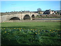
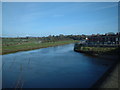
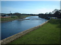
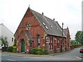
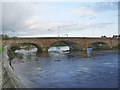
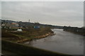
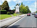
52 photos from this area
Area Information
Key information about the PR5 4AA including its size, population, and administrative classification.
- Area Type
- Postcode
- Area Size
- 1.8 hectares
- Population
- 1344
- Population Density
- 769 people/km²
House Prices in PR5 4AA
37
Properties
£104,702
Average Sold Price
£60,000
Lowest Price
£167,000
Highest Price
Showing 37 properties
| Address | Type | Beds | Baths | Last Sale Price | Last Sale Date | |
|---|---|---|---|---|---|---|
| 29 Victoria Road, Walton Le Dale, PR5 4AA | house | - | - | £60,000 | Jul 2025 | |
| 61 Victoria Road, Walton Le Dale, PR5 4AA | Terraced | 3 | 1 | £118,000 | May 2024 | |
| 11 Victoria Road, Walton Le Dale, PR5 4AA | Terraced | 2 | 1 | £98,000 | Feb 2024 | |
| 27 Victoria Road, Walton Le Dale, PR5 4AA | Terraced | 2 | 1 | £117,000 | Jan 2024 | |
| 13 Victoria Road, Walton Le Dale, PR5 4AA | Terraced | 2 | 1 | £119,200 | May 2023 | |
| 45 Victoria Road, Walton Le Dale, PR5 4AA | Terraced | 2 | 1 | £167,000 | Jan 2023 | |
| 25 Victoria Road, Walton Le Dale, PR5 4AA | Terraced | - | - | £115,000 | Nov 2021 | |
| 55 Victoria Road, Walton Le Dale, PR5 4AA | Terraced | 2 | 2 | £97,000 | Oct 2020 | |
| 19 Victoria Road, Walton Le Dale, PR5 4AA | Terraced | 3 | 1 | £105,000 | Apr 2018 | |
| 1 Victoria Road, Walton Le Dale, PR5 4AA | Terraced | 2 | 2 | £97,000 | Jan 2018 |
Page 1 of 4
Energy Efficiency in PR5 4AA
Amenities
Schools
| Rank | School | Type | Entry gender | Ages |
|---|
Explore more schools in this area
Go to Schools tabDemographics
Household Size
Two person
most common
Accommodation Type
Houses
most common
Tenure
80
majority
Ethnic Group
White
most common
Religion
N/A
most common
Household Composition
N/A
most common
Age
47
median
Adults (30-64 years)
most common
Household Deprivation
N/A
with no deprivation
NS-SEC
37
in Lower managerial occupations
Explore more demographic insights in this area
Go to Demographics tabPlanning
Planning Constraints
- Flood RiskPremium
- Ramsar Wetland SitesPremium
- Area of Outstanding Natural BeautyPremium
- Protected Nature ReservePremium
- Protected WoodlandPremium