Area Overview for PR5 0UE
Photos of PR5 0UE
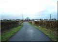
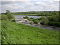
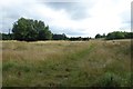
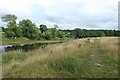
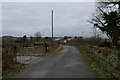
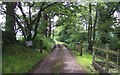
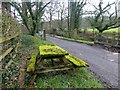
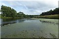
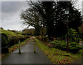
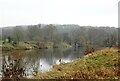
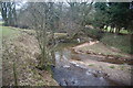
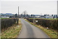
16 photos from this area
Area Information
Key information about the PR5 0UE including its size, population, and administrative classification.
- Area Type
- Postcode
- Area Size
- 96.1 hectares
- Population
- 1187
- Population Density
- 59 people/km²
House Prices in PR5 0UE
23
Properties
£245,075
Average Sold Price
£68,000
Lowest Price
£485,000
Highest Price
Showing 23 properties
| Address | Type | Beds | Baths | Last Sale Price | Last Sale Date | |
|---|---|---|---|---|---|---|
| St Leonards Vicarage, Potters Lane, Samlesbury, PR5 0UE | house | - | - | £485,000 | Mar 2025 | |
| The Shippon, Potters Lane, Samlesbury, PR5 0UE | house | 3 | 3 | £440,000 | Mar 2025 | |
| The Brambles, Potters Lane, Samlesbury, PR5 0UE | Semi-detached | 3 | 2 | £327,250 | Dec 2015 | |
| 2, White Cottages, Potters Lane, Samlesbury, PR5 0UE | Cottage | 2 | 1 | £180,000 | Feb 2011 | |
| Westray, Potters Lane, Samlesbury, PR5 0UE | house | 4 | 3 | £245,000 | Jul 2010 | |
| The New Boat House, Potters Lane, Samlesbury, PR5 0UE | Semi-detached | - | - | £100,000 | Apr 2007 | |
| Waters Edge, Potters Lane, Samlesbury, PR5 0UE | house | - | - | £335,000 | Oct 2006 | |
| The Oaks, Potters Lane, Samlesbury, PR5 0UE | Detached | - | - | £120,500 | Apr 2001 | |
| Riverside Cottage, Potters Lane, Samlesbury, PR5 0UE | house | - | - | £150,000 | Apr 2001 | |
| 1, White Cottages, Potters Lane, Samlesbury, PR5 0UE | Terraced | - | - | £68,000 | Aug 1998 |
Page 1 of 3
Energy Efficiency in PR5 0UE
Amenities
Schools
| Rank | School | Type | Entry gender | Ages |
|---|
Explore more schools in this area
Go to Schools tabDemographics
Household Size
Two person
most common
Accommodation Type
Houses
most common
Tenure
84
majority
Ethnic Group
White
most common
Religion
N/A
most common
Household Composition
N/A
most common
Age
47
median
Adults (30-64 years)
most common
Household Deprivation
N/A
with no deprivation
NS-SEC
42
in Lower managerial occupations
Explore more demographic insights in this area
Go to Demographics tabPlanning
Planning Constraints
- Flood RiskPremium
- Ramsar Wetland SitesPremium
- Area of Outstanding Natural BeautyPremium
- Protected Nature ReservePremium
- Protected WoodlandPremium