Area Overview for PR4 6US
Photos of PR4 6US
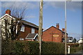
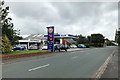
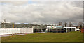
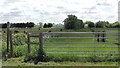
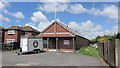
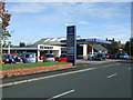
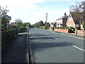
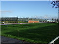
16 photos from this area
Area Information
Key information about the PR4 6US including its size, population, and administrative classification.
- Area Type
- Postcode
- Area Size
- 3.7 hectares
- Population
- 1522
- Population Density
- 256 people/km²
House Prices in PR4 6US
19
Properties
£246,056
Average Sold Price
£125,000
Lowest Price
£377,500
Highest Price
Showing 19 properties
| Address | Type | Beds | Baths | Last Sale Price | Last Sale Date | |
|---|---|---|---|---|---|---|
| Danefield, 38 Blackgate Lane, Tarleton, PR4 6US | Semi-detached | 3 | 1 | £333,000 | Feb 2023 | |
| 20 Blackgate Lane, Tarleton, PR4 6US | house | - | - | £145,000 | Jun 2022 | |
| 34 Blackgate Lane, Tarleton, PR4 6US | Bungalow | - | - | £265,000 | Sep 2021 | |
| 30 Blackgate Lane, Tarleton, PR4 6US | house | - | - | £377,500 | Feb 2021 | |
| 49 Blackgate Lane, Tarleton, PR4 6US | house | - | - | £340,000 | Jun 2016 | |
| 32 Blackgate Lane, Tarleton, PR4 6US | Bungalow | - | - | £235,000 | Jun 2016 | |
| 18 Blackgate Lane, Tarleton, PR4 6US | house | - | - | £125,000 | Apr 2013 | |
| 36 Blackgate Lane, Tarleton, PR4 6US | house | - | - | £164,000 | Mar 2009 | |
| 22 Blackgate Lane, Tarleton, PR4 6US | Bungalow | - | - | £230,000 | Jun 2008 | |
| 2 Blackgate Lane, Tarleton, PR4 6US | house | 3 | 1 | - | - |
Page 1 of 2
Energy Efficiency in PR4 6US
Amenities
Schools
| Rank | School | Type | Entry gender | Ages |
|---|
Explore more schools in this area
Go to Schools tabDemographics
Household Size
Two person
most common
Accommodation Type
Houses
most common
Tenure
71
majority
Ethnic Group
White
most common
Religion
N/A
most common
Household Composition
N/A
most common
Age
47
median
Adults (30-64 years)
most common
Household Deprivation
N/A
with no deprivation
NS-SEC
37
in Lower managerial occupations
Explore more demographic insights in this area
Go to Demographics tabPlanning
Planning Constraints
- Flood RiskPremium
- Ramsar Wetland SitesPremium
- Area of Outstanding Natural BeautyPremium
- Protected Nature ReservePremium
- Protected WoodlandPremium