Area Overview for PR4 6NG
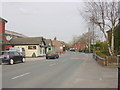
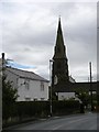
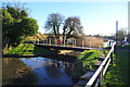
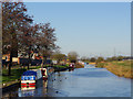
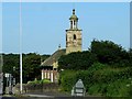
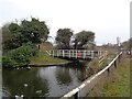
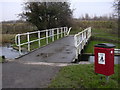
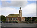
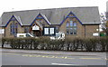
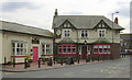
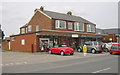
Photos of PR4 6NG

Area Information
PR4 6NG is a specific postcode area covering a small residential cluster just 6,785 square metres in size. This compact footprint supports a population of 1,522 people, creating a neighbourhood where residents share immediate communities. The location sits in England, offering a defined environment for those seeking a settled place to live. Daily life here revolves around a tight-knit group of neighbours, with the area's small scale meaning you are likely to know your neighbours shortly after moving in. The low population density of 256 people per square kilometre indicates spacious surroundings without the pressure of high-rise living. This specific cluster provides a stable living environment, distinct from larger, sprawling developments. When you consider living in PR4 6NG, you join a community defined by its manageable size and immediate accessibility. The area remains a functional residential zone where privacy and proximity coexist. You will find a home setting that balances local connectivity with the quiet comfort of a smaller household. This postcode offers a straightforward entry point into local life, without the complexity of navigating vast urban districts.
- Area Type
- Postcode
- Area Size
- 6785 m²
- Population
- 1522
- Population Density
- 256 people/km²
The property market in PR4 6NG is characterised by a high degree of stability and private ownership. With 71% of residents owning their homes, this area operates significantly more as an owner-occupied market than a rental hotspot. The vast majority of permanent accommodation types in this postcode cover houses rather than flats or other urban living formats. This housing stock profile means you will find single-family dwellings that suit larger families or individuals seeking space. Buyers looking at homes in PR4 6NG should expect to engage with owner-associates who have lived in the area for extended periods. The high ownership rate often correlates with lower rents and a slower price fluctuation cycle compared to high-density rental zones. When viewing properties, you are likely to encounter established estates where the character of the house often matches the tenure of the owner. This market structure provides security for buyers but may limit immediate rental flexibility if you are purchasing an investment property. The data clearly points to a community built on homeownership rather than transient leasing arrangements.
House Prices in PR4 6NG
Showing 10 properties
| Address | Type | Beds | Baths | Last Sale Price | Last Sale Date | |
|---|---|---|---|---|---|---|
| 3 Rectory Gardens, Tarleton, PR4 6NG | Detached | 4 | 1 | £350,000 | Jan 2024 | |
| 7 Rectory Gardens, Tarleton, PR4 6NG | house | - | - | £310,000 | Oct 2023 | |
| 1 Rectory Gardens, Tarleton, PR4 6NG | house | 4 | - | £325,000 | Nov 2019 | |
| 8 Rectory Gardens, Tarleton, PR4 6NG | house | - | - | £235,000 | Jul 2009 | |
| 5 Rectory Gardens, Tarleton, PR4 6NG | Detached | - | - | £249,950 | Oct 2003 | |
| 9 Rectory Gardens, Tarleton, PR4 6NG | Detached | 4 | - | £187,750 | Jun 2002 | |
| 4 Rectory Gardens, Tarleton, PR4 6NG | Detached | - | - | £144,950 | Jun 2002 | |
| 10 Rectory Gardens, Tarleton, PR4 6NG | house | - | - | £137,500 | Jun 2001 | |
| 6 Rectory Gardens, Tarleton, PR4 6NG | house | - | - | £118,950 | Feb 2001 | |
| 2 Rectory Gardens, Tarleton, PR4 6NG | Detached | - | - | £122,500 | Dec 2000 |
Energy Efficiency in PR4 6NG
Residents of PR4 6NG benefit from practical amenities located immediately within the neighbourhood. For daily shopping needs, you can access five retail outlets including Aldi Liverpool, Co-op Tarleton, and Spar. These venues are situated nearby, ensuring you never have to travel far for groceries or essentials. Connectivity to the wider region is supported by five nearby rail stations, specifically Croston Railway Station, Rufford Railway Station, and New Lane Railway Station. These stations provide train access for commuting or leisure trips across Merseyside and Lancashire. Air travel is possible via Warton Airport, which lies within practical reach should you need regional connectivity. Living in PR4 6NG offers a blend of local convenience and regional transport links. You can complete your weekly shop at Co-op Tarleton before commuting via one of the nearby rail stations. The presence of these specific venues means you do not need to look far for practical services. This accessibility ensures that your daily routine remains efficient and straightforward.
Amenities
Schools
Families living in PR4 6NG have access to specific educational facilities within practical reach. The nearest school is Tarleton Holy Trinity CofE Primary School, which serves as the main educational option for younger children in the immediate vicinity. While Tarleton Holy Trinity CofE Primary School holds a Ofsted rating of good, there is no data available for secondary options within this direct postcode cluster. The presence of a primary school suggests that younger families are embedded in the local community, although the lack of listed secondary schools means older students likely travel further for their education. When assessing schools near PR4 6NG, you must prioritise this single confirmed institution for early years. The concentration of a primary provider highlights the need for residents to plan for secondary schooling outside the immediate postcode boundary. You should verify travel times and catchment areas for Tarleton Holy Trinity CofE Primary School before committing to a home purchase. The current data confirms only this one primary option within the defined residential cluster.
| Rank | School | Type | Entry gender | Ages |
|---|
Explore more schools in this area
Go to Schools tabDemographics
The community in PR4 6NG reflects a mature demographic profile shaped by the local housing stock. The median age for residents is 47 years old, indicating a population centred on adulthood rather than young professionals or retirees. Most commonly, the area is occupied by adults between the ages of 30 and 64 years. This age range suggests a community likely supporting grown families or established households rather than students or single young adults. Home ownership stands at 71%, which is a notably high figure compared to national averages. This statistic confirms that the majority of residents have purchased their properties and are staying put. The predominant accommodation type is houses, aligning with the higher rate of ownership and mature age profile. White residents form the predominant ethnic group in this cluster, consistent with the established residential nature of the location. You can expect a neighbourhood where long-term local ties are strong, and property turnover is generally lower. The data shows a settled population that values stability over rapid change.
Household Size
Accommodation Type
Tenure
Ethnic Group
Religion
Household Composition
Age
Household Deprivation
NS-SEC
Explore more demographic insights in this area
Go to Demographics tabPlanning
Planning Constraints
- Flood RiskPremium
- Ramsar Wetland SitesPremium
- Area of Outstanding Natural BeautyPremium
- Protected Nature ReservePremium
- Protected WoodlandPremium