Area Overview for PR4 5ZA
Photos of PR4 5ZA
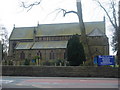
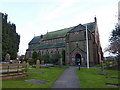
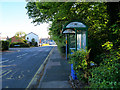
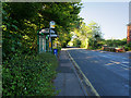
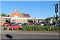
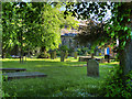

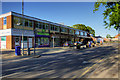
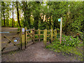
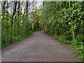
31 photos from this area
Area Information
Key information about the PR4 5ZA including its size, population, and administrative classification.
- Area Type
- Postcode
- Area Size
- 2.1 hectares
- Population
- 1404
- Population Density
- 2043 people/km²
House Prices in PR4 5ZA
32
Properties
£232,685
Average Sold Price
£41,000
Lowest Price
£835,000
Highest Price
Showing 32 properties
| Address | Type | Beds | Baths | Last Sale Price | Last Sale Date | |
|---|---|---|---|---|---|---|
| 53 School Lane, Longton, PR4 5ZA | Detached | 5 | 3 | £835,000 | Dec 2024 | |
| 77 School Lane, Longton, PR4 5ZA | Semi-detached | 2 | 1 | £218,000 | Aug 2024 | |
| 55 School Lane, Longton, PR4 5ZA | Detached | 4 | 3 | £600,000 | Apr 2024 | |
| 79 School Lane, Longton, PR4 5ZA | Semi-detached | 2 | 1 | £220,000 | Apr 2024 | |
| 59 School Lane, Longton, PR4 5ZA | Semi-detached | 2 | 1 | £180,000 | Sep 2023 | |
| 82 School Lane, Longton, PR4 5ZA | Semi-detached | 3 | 2 | £245,000 | Feb 2023 | |
| 85 School Lane, Longton, PR4 5ZA | Semi-detached | 2 | 1 | £218,000 | Aug 2022 | |
| 80 School Lane, Longton, PR4 5ZA | Retail | 3 | 2 | £235,000 | Apr 2022 | |
| 90 School Lane, Longton, PR4 5ZA | house | - | - | £190,000 | Jan 2022 | |
| 87 School Lane, Longton, PR4 5ZA | Bungalow | - | - | £160,300 | Jul 2021 |
Page 1 of 4
Energy Efficiency in PR4 5ZA
Amenities
Schools
| Rank | School | Type | Entry gender | Ages |
|---|
Explore more schools in this area
Go to Schools tabDemographics
Household Size
Two person
most common
Accommodation Type
Houses
most common
Tenure
82
majority
Ethnic Group
White
most common
Religion
N/A
most common
Household Composition
N/A
most common
Age
47
median
Adults (30-64 years)
most common
Household Deprivation
N/A
with no deprivation
NS-SEC
43
in Lower managerial occupations
Explore more demographic insights in this area
Go to Demographics tabPlanning
Planning Constraints
- Flood RiskPremium
- Ramsar Wetland SitesPremium
- Area of Outstanding Natural BeautyPremium
- Protected Nature ReservePremium
- Protected WoodlandPremium