Area Overview for PR4 5PH
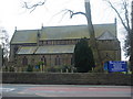
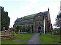
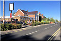
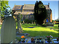
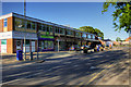
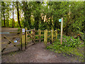
Photos of PR4 5PH

Area Information
Living in PR4 5PH offers a settled residential experience within a defined cluster of homes. This specific postcode covers just 9,572 square metres, indicating a tightly knit neighbourhood rather than a sprawling district. With a population of 1,404 residents, the area maintains an exceptionally high density of 146,675 people per square kilometre. This concentration creates an immediate sense of community, where neighbours are likely within close proximity to one another. The environment is distinctly residential, with properties focused on living rather than commercial activity. Because the area is so small, daily routines often involve short walks or local bus routes to reach larger shopping centres or transport links. You will find a quiet, forward-thinking residents' area where life moves at a steady pace. The high density means utilities and infrastructure are well-served, though the compact nature of the postcode suggests limited open green space within the immediate boundaries. For those seeking a specific, manageable community size, PR4 5PH delivers a straightforward, housed environment without the complexity of larger urban developments.
- Area Type
- Postcode
- Area Size
- 9572 m²
- Population
- 1404
- Population Density
- 2043 people/km²
The property market in PR4 5PH is an owner-occupier zone defined by detached or semi-detached houses. With 82% of residents owning their homes, the market is dominated by buyers who have invested in the area for stability. The accommodation type is strictly houses, which appeals to those seeking traditional architecture and private gardens rather than urban living in a flat. This small postcode area does not cater to the high-rise rental market; instead, it serves families and individuals looking to settle down. A homebuyer considering PR4 5PH is entering a low-turnover market where properties are often sold within wider clusters or from estates passed down through generations. The lack of rental units means there is no landlord influence on the immediate streetscape. Potential buyers should examine the wider Preston area for investment opportunities, as PR4 5PH itself is a static, low-density residential pocket. The housing stock is unlikely to include new builds or luxury conversions, focusing instead on established, functional family homes.
House Prices in PR4 5PH
Showing 14 properties
| Address | Type | Beds | Baths | Last Sale Price | Last Sale Date | |
|---|---|---|---|---|---|---|
| 10 Shirley Lane, Longton, PR4 5PH | Detached | 2 | 1 | £245,000 | Feb 2025 | |
| 2 Shirley Lane, Longton, PR4 5PH | Semi-detached | 3 | 1 | £177,500 | Dec 2020 | |
| 4 Shirley Lane, Longton, PR4 5PH | Semi-detached | 3 | 1 | £195,000 | Sep 2020 | |
| The Holliers, Shirley Lane, Longton, PR4 5PH | Bungalow | 4 | 1 | £383,000 | Jun 2020 | |
| 8 Shirley Lane, Longton, PR4 5PH | Semi-detached | 3 | 1 | £155,000 | Aug 2018 | |
| Beech Lodge, Shirley Lane, Longton, PR4 5PH | Bungalow | - | - | £300,000 | Jun 2018 | |
| 6 Shirley Lane, Longton, PR4 5PH | Semi-detached | - | - | £162,500 | Nov 2007 | |
| Birch Tree House, Shirley Lane, Longton, PR4 5PH | Detached | 4 | 3 | £400,000 | Jul 2005 | |
| 3 Shirley Lane, Longton, PR4 5PH | Semi-detached | 4 | 1 | £44,000 | Mar 2001 | |
| Yew Tree House, Shirley Lane, Longton, PR4 5PH | Semi-detached | - | - | £180,000 | Apr 1997 |
Energy Efficiency in PR4 5PH
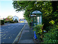
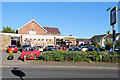
Daily life in PR4 5PH revolves around practical access to essential services within a short distance. Residents can choose from five retail options, including Booths Longton, Spar, and another Spar outlet, providing access to groceries, alcohol, and essentials without needing to travel far. For larger procurement or daily commutes, rail transport is the primary mode, with five stations listed in the immediate vicinity. Preston Railway Station serves as the main hub, while Salwick and Lostock Hall stations offer alternative interchange points nearby. There is also one airport, Warton Airport, located close by, though this primarily serves general and private aviation rather than commercial passenger flights. The combination of local shops and major rail links means you need less for daily living while maintaining good regional connectivity. This setup creates a balanced lifestyle where you can run errands locally but still access national networks quickly.
Amenities
Schools
Families living in PR4 5PH are served by three specific educational institutions in their immediate vicinity. Longton Primary School is a primary school holding a Good Ofsted rating, which signals reliable education standards. You will also find Longton County Infant School and Longton County Junior School supporting the local catchment. This combination suggests a robust local education chain, allowing children to remain in the same educational system from infancy through to upper primary years, or potentially moving between the infant and junior sections if catchment areas permit. Access to a Good-rated institution like Longton Primary School is a significant asset for any parent selecting homes in this postcode. The presence of multiple schools indicates that the surrounding postcode area, likely PR4 9PD or similar, has invested in educational infrastructure. Prospective homebuyers should verify specific catchment boundaries with the individual schools to ensure their child qualifies for attendance.
| Rank | School | Type | Entry gender | Ages |
|---|
Explore more schools in this area
Go to Schools tabDemographics
The community in PR4 5PH is characterised by a mature household profile. The median age stands at 47 years, placing adults aged between 30 and 64 as the most common age range. This demographic skew suggests the area attracts families and professionals in their middle years rather than young students or retirees. Home ownership is the norm here, with 82% of residents owning their properties outright or with a mortgage. This high rate of ownership contributes to long-term local commitment and community stability. Predominantly white households form the bulk of the population, reflecting the traditional character of many established residential zones in this part of England. The accommodation type is exclusively houses, meaning you will not find flats or purpose-built rental blocks within this specific cluster. This housing mix aligns perfectly with the high ownership rate and the mature age of residents. There is little transient population, reinforcing the area as a place where families plant roots for the long term.
Household Size
Accommodation Type
Tenure
Ethnic Group
Religion
Household Composition
Age
Household Deprivation
NS-SEC
Explore more demographic insights in this area
Go to Demographics tabPlanning
Planning Constraints
- Flood RiskPremium
- Ramsar Wetland SitesPremium
- Area of Outstanding Natural BeautyPremium
- Protected Nature ReservePremium
- Protected WoodlandPremium