Area Overview for PR4 5JE
Photos of PR4 5JE
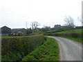
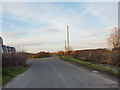
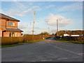
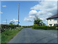
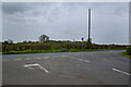
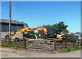
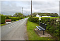
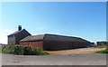
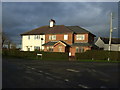
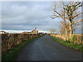
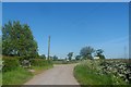
11 photos from this area
Area Information
Key information about the PR4 5JE including its size, population, and administrative classification.
- Area Type
- Postcode
- Area Size
- 92.7 hectares
- Population
- 1336
- Population Density
- 153 people/km²
House Prices in PR4 5JE
34
Properties
£336,800
Average Sold Price
£115,500
Lowest Price
£587,500
Highest Price
Showing 34 properties
| Address | Type | Beds | Baths | Last Sale Price | Last Sale Date | |
|---|---|---|---|---|---|---|
| Cleggs Cottage, Grange Lane, Hutton, PR4 5JE | Detached | - | - | £200,000 | Jul 2024 | |
| Hesketh Farm, Grange Lane, Hutton, PR4 5JE | house | - | - | £587,500 | Jun 2023 | |
| Grange Side, Grange Lane, Hutton, PR4 5JE | house | - | - | £495,000 | Oct 2020 | |
| The Knoll, Grange Lane, Hutton, PR4 5JE | house | - | - | £115,500 | Apr 2019 | |
| Fieldside, Grange Lane, Hutton, PR4 5JE | Bungalow | 2 | 2 | £405,000 | Nov 2018 | |
| The Briars, Grange Lane, Hutton, PR4 5JE | Detached | 6 | - | £500,000 | Oct 2013 | |
| Ashtree Cottage, Grange Lane, Hutton, PR4 5JE | Detached | - | - | £355,000 | Jun 2007 | |
| Guild Farm House, Grange Lane, Hutton, PR4 5JE | Detached | 4 | 1 | £250,000 | Jan 2007 | |
| Willow Cottage, Grange Lane, Hutton, PR4 5JE | Semi-detached | - | - | £300,000 | Dec 2006 | |
| Gamekeepers Farm Cottage, Grange Lane, Hutton, PR4 5JE | Detached | - | - | £160,000 | May 2001 |
Page 1 of 4
Energy Efficiency in PR4 5JE
Amenities
Schools
| Rank | School | Type | Entry gender | Ages |
|---|
Explore more schools in this area
Go to Schools tabDemographics
Household Size
Two person
most common
Accommodation Type
Houses
most common
Tenure
90
majority
Ethnic Group
White
most common
Religion
N/A
most common
Household Composition
N/A
most common
Age
47
median
Adults (30-64 years)
most common
Household Deprivation
N/A
with no deprivation
NS-SEC
40
in Lower managerial occupations
Explore more demographic insights in this area
Go to Demographics tabPlanning
Planning Constraints
- Flood RiskPremium
- Ramsar Wetland SitesPremium
- Area of Outstanding Natural BeautyPremium
- Protected Nature ReservePremium
- Protected WoodlandPremium