Area Overview for PR4 4XD
Photos of PR4 4XD

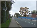
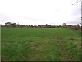
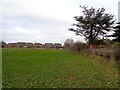
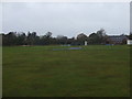
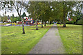
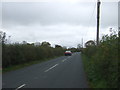
11 photos from this area
Area Information
Key information about the PR4 4XD including its size, population, and administrative classification.
- Area Type
- Postcode
- Area Size
- 2.6 hectares
- Population
- 1608
- Population Density
- 418 people/km²
House Prices in PR4 4XD
35
Properties
£173,277
Average Sold Price
£59,500
Lowest Price
£272,500
Highest Price
Showing 35 properties
| Address | Type | Beds | Baths | Last Sale Price | Last Sale Date | |
|---|---|---|---|---|---|---|
| 30 Southfield Drive, New Longton, PR4 4XD | Bungalow | 2 | 1 | £250,000 | Feb 2023 | |
| 8 Southfield Drive, New Longton, PR4 4XD | Bungalow | 2 | - | £225,000 | Aug 2022 | |
| 10 Southfield Drive, New Longton, PR4 4XD | Bungalow | - | - | £250,000 | Jan 2022 | |
| 20 Southfield Drive, New Longton, PR4 4XD | Bungalow | - | - | £272,500 | May 2021 | |
| 24 Southfield Drive, New Longton, PR4 4XD | Bungalow | 2 | 1 | £179,950 | Oct 2019 | |
| 32 Southfield Drive, New Longton, PR4 4XD | Bungalow | 2 | 1 | £210,000 | Aug 2019 | |
| 27 Southfield Drive, New Longton, PR4 4XD | Bungalow | 2 | 1 | £150,000 | Jun 2019 | |
| 34 Southfield Drive, New Longton, PR4 4XD | Bungalow | 2 | - | £212,000 | Jan 2018 | |
| 11 Southfield Drive, New Longton, PR4 4XD | Bungalow | 2 | 1 | £218,000 | Dec 2017 | |
| 33 Southfield Drive, New Longton, PR4 4XD | Bungalow | 2 | 1 | £161,000 | Feb 2017 |
Page 1 of 4
Energy Efficiency in PR4 4XD
Amenities
Schools
| Rank | School | Type | Entry gender | Ages |
|---|
Explore more schools in this area
Go to Schools tabDemographics
Household Size
Two person
most common
Accommodation Type
Houses
most common
Tenure
87
majority
Ethnic Group
White
most common
Religion
N/A
most common
Household Composition
N/A
most common
Age
47
median
Adults (30-64 years)
most common
Household Deprivation
N/A
with no deprivation
NS-SEC
41
in Lower managerial occupations
Explore more demographic insights in this area
Go to Demographics tabPlanning
Planning Constraints
- Flood RiskPremium
- Ramsar Wetland SitesPremium
- Area of Outstanding Natural BeautyPremium
- Protected Nature ReservePremium
- Protected WoodlandPremium