Area Overview for PR4 4LE
Photos of PR4 4LE
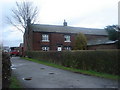

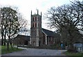

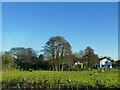

20 photos from this area
Area Information
Key information about the PR4 4LE including its size, population, and administrative classification.
- Area Type
- Postcode
- Area Size
- 19.1 hectares
- Population
- 1554
- Population Density
- 1041 people/km²
House Prices in PR4 4LE
13
Properties
£339,875
Average Sold Price
£285,000
Lowest Price
£380,000
Highest Price
Showing 13 properties
| Address | Type | Beds | Baths | Last Sale Price | Last Sale Date | |
|---|---|---|---|---|---|---|
| Deneroyd, 39 Chain House Lane, Whitestake, PR4 4LE | Bungalow | 3 | 2 | £380,000 | Dec 2024 | |
| Lever Lodge, 34 Chain House Lane, Whitestake, PR4 4LE | Bungalow | - | - | £335,500 | May 2021 | |
| Ashdene, 16 Chain House Lane, Whitestake, PR4 4LE | house | - | - | £285,000 | Jun 2011 | |
| Cerasus Lodge, 30 Chain House Lane, Whitestake, PR4 4LE | Detached | - | - | £359,000 | Oct 2004 | |
| Oakdene, 7 Chain House Lane, Whitestake, PR4 4LE | Detached | 5 | 5 | - | - | |
| Lever Edge, 32 Chain House Lane, Whitestake, PR4 4LE | house | 4 | - | - | - | |
| Stoney Croft, 28 Chain House Lane, Whitestake, PR4 4LE | Detached | - | - | - | - | |
| Moss Brook, 41 Chain House Lane, Whitestake, PR4 4LE | Detached | - | - | - | - | |
| Braids Farm, 12 Chain House Lane, Whitestake, PR4 4LE | house | - | - | - | - | |
| The Bungalow, 21 Chain House Lane, Whitestake, PR4 4LE | Bungalow | 3 | 1 | - | - |
Page 1 of 2
Energy Efficiency in PR4 4LE
Amenities
Schools
| Rank | School | Type | Entry gender | Ages |
|---|
Explore more schools in this area
Go to Schools tabDemographics
Household Size
Two person
most common
Accommodation Type
Houses
most common
Tenure
73
majority
Ethnic Group
White
most common
Religion
N/A
most common
Household Composition
N/A
most common
Age
47
median
Adults (30-64 years)
most common
Household Deprivation
N/A
with no deprivation
NS-SEC
31
in Lower managerial occupations
Explore more demographic insights in this area
Go to Demographics tabPlanning
Planning Constraints
- Flood RiskPremium
- Ramsar Wetland SitesPremium
- Area of Outstanding Natural BeautyPremium
- Protected Nature ReservePremium
- Protected WoodlandPremium