Area Overview for PR4 4BL
Photos of PR4 4BL
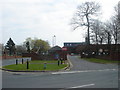
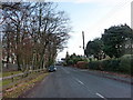
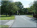
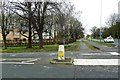
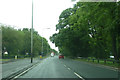
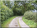
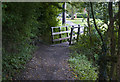
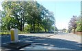
11 photos from this area
Area Information
Key information about the PR4 4BL including its size, population, and administrative classification.
- Area Type
- Postcode
- Area Size
- 4650 m²
- Population
- 1763
- Population Density
- 580 people/km²
House Prices in PR4 4BL
24
Properties
£149,003
Average Sold Price
£113,995
Lowest Price
£240,000
Highest Price
Showing 24 properties
| Address | Type | Beds | Baths | Last Sale Price | Last Sale Date | |
|---|---|---|---|---|---|---|
| 1 Halliwell Crescent, Hutton, PR4 4BL | Flat | - | - | £142,500 | Mar 2023 | |
| 19 Halliwell Crescent, Hutton, PR4 4BL | Flat | 2 | 2 | £169,950 | Nov 2022 | |
| 4 Halliwell Crescent, Hutton, PR4 4BL | Flat | 2 | 2 | £156,000 | Sep 2022 | |
| 18 Halliwell Crescent, Hutton, PR4 4BL | Flat | 4 | 2 | £240,000 | Aug 2022 | |
| 6 Halliwell Crescent, Hutton, PR4 4BL | Flat | 2 | 2 | £177,500 | Jul 2022 | |
| 20 Halliwell Crescent, Hutton, PR4 4BL | Flat | - | - | £153,000 | Jun 2022 | |
| 22 Halliwell Crescent, Hutton, PR4 4BL | Flat | - | - | £139,000 | Oct 2021 | |
| 10 Halliwell Crescent, Hutton, PR4 4BL | Flat | - | - | £170,000 | Sep 2021 | |
| 3 Halliwell Crescent, Hutton, PR4 4BL | Flat | 2 | 2 | £152,000 | Sep 2021 | |
| 12 Halliwell Crescent, Hutton, PR4 4BL | Flat | 2 | 2 | £124,950 | Dec 2016 |
Page 1 of 3
Energy Efficiency in PR4 4BL
Amenities
Schools
| Rank | School | Type | Entry gender | Ages |
|---|
Explore more schools in this area
Go to Schools tabDemographics
Household Size
Two person
most common
Accommodation Type
Houses
most common
Tenure
89
majority
Ethnic Group
White
most common
Religion
N/A
most common
Household Composition
N/A
most common
Age
47
median
Adults (30-64 years)
most common
Household Deprivation
N/A
with no deprivation
NS-SEC
45
in Lower managerial occupations
Explore more demographic insights in this area
Go to Demographics tabPlanning
Planning Constraints
- Flood RiskPremium
- Ramsar Wetland SitesPremium
- Area of Outstanding Natural BeautyPremium
- Protected Nature ReservePremium
- Protected WoodlandPremium