Area Overview for PR4 3UE
Photos of PR4 3UE
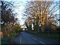
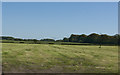
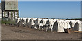
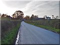
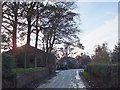
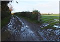
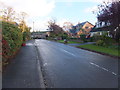
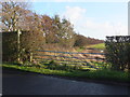
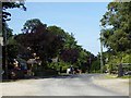
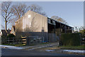
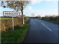
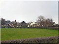
14 photos from this area
Area Information
Key information about the PR4 3UE including its size, population, and administrative classification.
- Area Type
- Postcode
- Area Size
- 2.0 km²
- Population
- 1751
- Population Density
- 57 people/km²
House Prices in PR4 3UE
23
Properties
£315,730
Average Sold Price
£62,950
Lowest Price
£695,000
Highest Price
Showing 23 properties
| Address | Type | Beds | Baths | Last Sale Price | Last Sale Date | |
|---|---|---|---|---|---|---|
| The Starling, Roseacre Road, Treales Roseacre And Wharles, PR4 3UE | Detached | 4 | 2 | £397,500 | Jul 2025 | |
| Holmeswood, Roseacre Road, Treales Roseacre And Wharles, PR4 3UE | Bungalow | 3 | 2 | £350,000 | Oct 2022 | |
| Rosewood, Roseacre Road, Treales Roseacre And Wharles, PR4 3UE | Detached | 3 | 1 | £255,000 | May 2022 | |
| White Moss, Roseacre Road, Treales Roseacre And Wharles, PR4 3UE | house | - | - | £300,500 | Mar 2022 | |
| 2, Derby Lodge Cottage, Roseacre Road, Treales Roseacre And Wharles, PR4 3UE | Semi-detached | 3 | 1 | £265,000 | Mar 2022 | |
| Woodbine Cottage, Roseacre Road, Treales Roseacre And Wharles, PR4 3UE | house | - | - | £695,000 | Jun 2021 | |
| Stanley Farm, Roseacre Road, Treales Roseacre And Wharles, PR4 3UE | Detached | 4 | 4 | £575,000 | Feb 2020 | |
| Post Farm, Roseacre Road, Treales Roseacre And Wharles, PR4 3UE | house | - | - | £540,000 | Nov 2019 | |
| Prospect Cottage, Roseacre Road, Treales Roseacre And Wharles, PR4 3UE | house | - | - | £350,000 | Sep 2019 | |
| Packwood, Roseacre Road, Treales Roseacre And Wharles, PR4 3UE | Detached | 3 | - | £272,000 | Apr 2015 |
Page 1 of 3
Energy Efficiency in PR4 3UE
Amenities
Schools
| Rank | School | Type | Entry gender | Ages |
|---|
Explore more schools in this area
Go to Schools tabDemographics
Household Size
Two person
most common
Accommodation Type
Houses
most common
Tenure
78
majority
Ethnic Group
White
most common
Religion
N/A
most common
Household Composition
N/A
most common
Age
47
median
Adults (30-64 years)
most common
Household Deprivation
N/A
with no deprivation
NS-SEC
42
in Lower managerial occupations
Explore more demographic insights in this area
Go to Demographics tabPlanning
Planning Constraints
- Flood RiskPremium
- Ramsar Wetland SitesPremium
- Area of Outstanding Natural BeautyPremium
- Protected Nature ReservePremium
- Protected WoodlandPremium