Area Overview for PR4 3SD
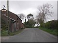
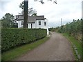
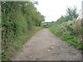
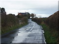
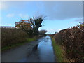
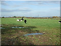
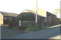
Photos of PR4 3SD

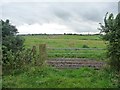
![Large field, north side of Mowbreck Lane [1] in PR4 3SD](https://images.propbar.co.uk/images/geograph/46/89/4689551_120.jpg)
![Large field, north of Mowbreck Lane [2] in PR4 3SD](https://images.propbar.co.uk/images/geograph/46/89/4689553_120.jpg)
16 photos from this area
Area Information
Key information about the PR4 3SD including its size, population, and administrative classification.
- Area Type
- Postcode
- Area Size
- 24.1 hectares
- Population
- 1751
- Population Density
- 57 people/km²
House Prices in PR4 3SD
30
Properties
£292,790
Average Sold Price
£78,000
Lowest Price
£560,000
Highest Price
Showing 30 properties
| Address | Type | Beds | Baths | Last Sale Price | Last Sale Date | |
|---|---|---|---|---|---|---|
| Oak House, Kirkham Road, Treales Roseacre And Wharles, PR4 3SD | house | - | - | £560,000 | Oct 2024 | |
| Woodlands, Kirkham Road, Treales Roseacre And Wharles, PR4 3SD | Detached | 3 | 2 | £310,000 | Nov 2021 | |
| Stanley Farm House, Kirkham Road, Treales Roseacre And Wharles, PR4 3SD | Farm | 5 | 2 | £345,000 | Jun 2021 | |
| White Hall, Kirkham Road, Treales Roseacre And Wharles, PR4 3SD | Detached | 4 | - | £140,000 | Jan 2017 | |
| Ramblings, Kirkham Road, Treales Roseacre And Wharles, PR4 3SD | Detached | 4 | 1 | £203,000 | May 2016 | |
| Orchard Cottage, Kirkham Road, Treales Roseacre And Wharles, PR4 3SD | Semi-detached | - | - | £325,000 | Sep 2006 | |
| Birch House, Kirkham Road, Treales Roseacre And Wharles, PR4 3SD | house | - | - | £425,000 | Jul 2006 | |
| Whitegarth, Kirkham Road, Treales Roseacre And Wharles, PR4 3SD | Detached | - | - | £249,106 | Jun 2001 | |
| Huddle House, Kirkham Road, Treales Roseacre And Wharles, PR4 3SD | Detached | - | - | £78,000 | Dec 1995 | |
| 2, The Granary, White Hall, Kirkham Road, Treales Roseacre And Wharles, PR4 3SD | Semi-detached | 4 | 3 | - | - |
Page 1 of 3
Energy Efficiency in PR4 3SD
Amenities
Schools
| Rank | School | Type | Entry gender | Ages |
|---|
Explore more schools in this area
Go to Schools tabDemographics
Household Size
Two person
most common
Accommodation Type
Houses
most common
Tenure
78
majority
Ethnic Group
White
most common
Religion
N/A
most common
Household Composition
N/A
most common
Age
47
median
Adults (30-64 years)
most common
Household Deprivation
N/A
with no deprivation
NS-SEC
42
in Lower managerial occupations
Explore more demographic insights in this area
Go to Demographics tabPlanning
Planning Constraints
- Flood RiskPremium
- Ramsar Wetland SitesPremium
- Area of Outstanding Natural BeautyPremium
- Protected Nature ReservePremium
- Protected WoodlandPremium