Area Overview for PR4 3JQ
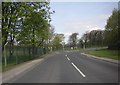
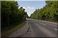
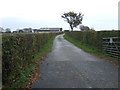
Photos of PR4 3JQ

Area Information
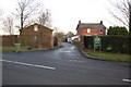
Living in PR4 3JQ means residing in a defined postcode cluster in Lancashire, England. This small residential area spans 7.3 hectares and houses a population of 1,845 people. The location offers a specific pocket of housing within the wider region, characterised by a dense but manageable community layout. Residents here navigate a neighbourhood where local streets connect to broader transport links without the crowding found in larger urban centres. Daily life revolves around specific, named points of interest rather than generic city centres. You drive or take public transport from your home to access stations in Poulton and Kirkham. The area provides a practical living environment for those seeking a settled home rather than a bustling city flat. Your morning commute begins from a home that sits within a clearly bounded residential zone. The 7.3 hectare footprint ensures you are part of a distinct local cluster, separate from neighbouring terraces or sprawling developments. This concentration allows for a focused community experience where neighbours know each other better than in larger, dispersed suburbs.
- Area Type
- Postcode
- Area Size
- 7.3 hectares
- Population
- 1845
- Population Density
- 109 people/km²
The property market in PR4 3JQ is defined by single-family homes and high owner occupancy. Houses constitute the primary accommodation type in this postcode area. Fifty-eight percent of residents are homeowners, signalling a market where individuals buy rather than rent. This preference for ownership shapes the local real estate landscape alongside the predominance of detached or semi-detached houses. You will find very few flats or apartments in this specific 7.3 hectare zone. The high home ownership percentage suggests that property prices reflect long-term investment value rather than speculative rental yields. Buying a home here secures a permanent stake in a stable community. The market offers houses suited to established families rather than investors seeking short-term rental income. Potential buyers looking for PR4 3JQ homes will encounter a stock designed for people who intend to stay. Local estate agents note the scarcity of rental properties due to this strong ownership culture.
House Prices in PR4 3JQ
Showing 1 properties
| Address | Type | Beds | Baths | Last Sale Price | Last Sale Date | |
|---|---|---|---|---|---|---|
| Tennis 152M From Weeton Camp, Singleton Road 16M From Gibraltar Road, Anzio Road, Weeton With Preese, PR4 3JQ | Leisure | - | - | - | - |
Energy Efficiency in PR4 3JQ
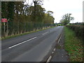
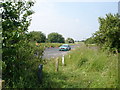
Amenities within practical reach of PR4 3JQ include specific retailers and transport hubs. Five local shops or larger stores serve daily retail needs, including Spar, Morrisons Daily, and Lidl Poulton-le. These venues provide essential groceries and household supplies without requiring a long drive. Five railway stations connect you to Kirkham, Wesham, and Moss Side, facilitating travel to Lancashire cities. You can access North Station, Talbot Road, and Pleasant Street stations for broader regional travel. Two airports, Blackpool International and Warton, sit nearby for those needing air travel. A central coach station handles scheduled bus services for the area. The concentration of transport options within a short distance reduces reliance on private car usage for long journeys. Residents access leisure facilities likely located near these transport nodes. The presence of Spar, Morrisons, and Lidl ensures you do not need to drive far for basics.
Amenities
Schools
Families in PR4 3JQ are served by two nearby primary schools, both holding good Ofsted ratings. Weeton Primary School operates as a state-funded primary institution within walking or cycling distance for many residents. Weeton St Michael's Church of England Voluntary Aided Primary School also serves the local catchment area with a good rating from inspectors. These two options provide denominational and secular educational choices with verified quality standards. Neither school appears in the data as a secondary institution, indicating the area caters primarily to young children or relies on other zones for teenagers. Parents choosing homes in PR4 3JQ benefit from immediate access to education for primary-aged pupils. The availability of two state schools rated good ensures that children receive an education meeting national expectations. You can register children at these facilities without crossing administrative borders to find suitable learning environments.
| Rank | School | Type | Entry gender | Ages |
|---|
Explore more schools in this area
Go to Schools tabDemographics
The community in PR4 3JQ reflects a settled, established demographic profile. The median age of residents is 47 years, indicating a mature population base. Most people living here fall into the 30 to 64 year old adult range. This age distribution suggests a neighbourhood favoured by families and professionals nearing retirement. Home ownership stands at 58%, which is above the national average for many British regions. Two-fifths of the households own their homes outright or have significant equity. This high ownership rate implies lower tenant turnover and stronger local investment. The predominant ethnic group in PR4 3JQ is White, defining the cultural makeup of the neighbourhood. Housing stock consists mainly of houses rather than flats or apartments, catering to families and larger households. With a population density of 109 people per square kilometre, the area feels spacious compared to London or the south east. The age and ownership data recommend this location for anyone seeking stability and community in a traditional house.
Household Size
Accommodation Type
Tenure
Ethnic Group
Religion
Household Composition
Age
Household Deprivation
NS-SEC
Explore more demographic insights in this area
Go to Demographics tabPlanning
Planning Constraints
- Flood RiskPremium
- Ramsar Wetland SitesPremium
- Area of Outstanding Natural BeautyPremium
- Protected Nature ReservePremium
- Protected WoodlandPremium