Area Overview for PR4 3HS
Photos of PR4 3HS
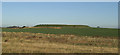

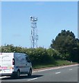

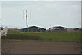
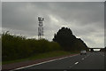
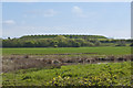
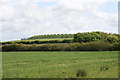

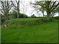
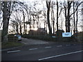
17 photos from this area
Area Information
Key information about the PR4 3HS including its size, population, and administrative classification.
- Area Type
- Postcode
- Area Size
- 50.2 hectares
- Population
- 1845
- Population Density
- 109 people/km²
House Prices in PR4 3HS
13
Properties
£277,714
Average Sold Price
£175,000
Lowest Price
£400,000
Highest Price
Showing 13 properties
| Address | Type | Beds | Baths | Last Sale Price | Last Sale Date | |
|---|---|---|---|---|---|---|
| 4, The Barns, Back Lane, Weeton With Preese, PR4 3HS | house | - | - | £295,000 | Jul 2023 | |
| Kineton Lodge, Back Lane, Weeton With Preese, PR4 3HS | Detached | - | - | £400,000 | Mar 2021 | |
| 5, The Barns, Back Lane, Weeton With Preese, PR4 3HS | house | 4 | - | £375,000 | Aug 2015 | |
| 3, The Barns, Back Lane, Weeton With Preese, PR4 3HS | Terraced | - | - | £240,000 | Feb 2006 | |
| 1, The Barns, Back Lane, Weeton With Preese, PR4 3HS | Flat | - | - | £249,000 | Nov 2002 | |
| 2, The Barns, Back Lane, Weeton With Preese, PR4 3HS | Terraced | - | - | £175,000 | Nov 2002 | |
| Hollybush Farm, Back Lane, Weeton With Preese, PR4 3HS | house | 5 | 1 | £210,000 | May 1995 | |
| Windmill Farm, Back Lane, Weeton With Preese, PR4 3HS | Detached | 4 | 3 | - | - | |
| Keepers, Back Lane, Weeton With Preese, PR4 3HS | undefined | - | - | - | - | |
| Weatheroak, Weeton Lane Heads, Back Lane, Weeton With Preese, PR4 3HS | Detached | - | - | - | - |
Page 1 of 2
Energy Efficiency in PR4 3HS
Amenities
Schools
| Rank | School | Type | Entry gender | Ages |
|---|
Explore more schools in this area
Go to Schools tabDemographics
Household Size
Two person
most common
Accommodation Type
Houses
most common
Tenure
58
majority
Ethnic Group
White
most common
Religion
N/A
most common
Household Composition
N/A
most common
Age
47
median
Adults (30-64 years)
most common
Household Deprivation
N/A
with no deprivation
NS-SEC
40
in Lower managerial occupations
Explore more demographic insights in this area
Go to Demographics tabPlanning
Planning Constraints
- Flood RiskPremium
- Ramsar Wetland SitesPremium
- Area of Outstanding Natural BeautyPremium
- Protected Nature ReservePremium
- Protected WoodlandPremium