Area Overview for PR4 3HJ
Photos of PR4 3HJ
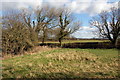
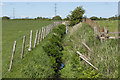
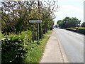
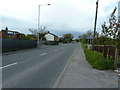
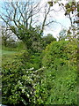
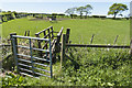
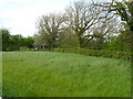
7 photos from this area
Area Information
Key information about the PR4 3HJ including its size, population, and administrative classification.
- Area Type
- Postcode
- Area Size
- 1.0 km²
- Population
- 1422
- Population Density
- 76 people/km²
House Prices in PR4 3HJ
22
Properties
£390,409
Average Sold Price
£157,500
Lowest Price
£612,000
Highest Price
Showing 22 properties
| Address | Type | Beds | Baths | Last Sale Price | Last Sale Date | |
|---|---|---|---|---|---|---|
| Raikes Barn, Fleetwood Road, Greenhalgh With Thistleton, PR4 3HJ | Semi-detached | 5 | 3 | £612,000 | Dec 2024 | |
| The Old Farmhouse, Fleetwood Road, Greenhalgh With Thistleton, PR4 3HJ | Detached | 4 | 1 | £450,000 | Aug 2024 | |
| Bridgeway, Fleetwood Road, Greenhalgh With Thistleton, PR4 3HJ | Bungalow | 3 | 1 | £330,000 | Apr 2023 | |
| Albany House, Fleetwood Road, Greenhalgh With Thistleton, PR4 3HJ | Detached | 4 | 2 | £395,000 | Dec 2021 | |
| Guild Farm, Fleetwood Road, Greenhalgh With Thistleton, PR4 3HJ | house | - | - | £565,000 | Jun 2021 | |
| Wagtails Barn, Fleetwood Road, Greenhalgh With Thistleton, PR4 3HJ | house | - | - | £460,000 | Mar 2021 | |
| Holly House, Fleetwood Road, Greenhalgh With Thistleton, PR4 3HJ | house | - | - | £225,000 | Nov 2020 | |
| Fair Bank, Fleetwood Road, Greenhalgh With Thistleton, PR4 3HJ | house | - | - | £565,000 | Jan 2017 | |
| Westlyn, Fleetwood Road, Greenhalgh With Thistleton, PR4 3HJ | Bungalow | - | - | £185,000 | Mar 2014 | |
| Birch Cottage, Fleetwood Road, Greenhalgh With Thistleton, PR4 3HJ | Semi-detached | 3 | 2 | £157,500 | Aug 2005 |
Page 1 of 3
Energy Efficiency in PR4 3HJ
Amenities
Schools
| Rank | School | Type | Entry gender | Ages |
|---|
Explore more schools in this area
Go to Schools tabDemographics
Household Size
Two person
most common
Accommodation Type
Houses
most common
Tenure
79
majority
Ethnic Group
White
most common
Religion
N/A
most common
Household Composition
N/A
most common
Age
47
median
Adults (30-64 years)
most common
Household Deprivation
N/A
with no deprivation
NS-SEC
40
in Lower managerial occupations
Explore more demographic insights in this area
Go to Demographics tabPlanning
Planning Constraints
- Flood RiskPremium
- Ramsar Wetland SitesPremium
- Area of Outstanding Natural BeautyPremium
- Protected Nature ReservePremium
- Protected WoodlandPremium