Area Overview for PR4 3AW
Photos of PR4 3AW

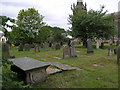


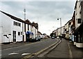
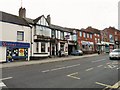
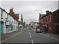
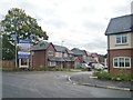
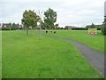
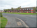
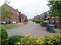
77 photos from this area
Area Information
Key information about the PR4 3AW including its size, population, and administrative classification.
- Area Type
- Postcode
- Area Size
- 4567 m²
- Population
- 1715
- Population Density
- 3971 people/km²
House Prices in PR4 3AW
23
Properties
£77,880
Average Sold Price
£37,500
Lowest Price
£118,460
Highest Price
Showing 23 properties
| Address | Type | Beds | Baths | Last Sale Price | Last Sale Date | |
|---|---|---|---|---|---|---|
| 12 Windmill View, Medlar With Wesham, PR4 3AW | Flat | - | - | £73,136 | Nov 2024 | |
| 15 Windmill View, Medlar With Wesham, PR4 3AW | Terraced | 2 | 1 | £112,225 | May 2022 | |
| 18 Windmill View, Medlar With Wesham, PR4 3AW | Terraced | 3 | 1 | £118,460 | May 2022 | |
| 9 Windmill View, Medlar With Wesham, PR4 3AW | house | 2 | - | £108,069 | Feb 2022 | |
| 17 Windmill View, Medlar With Wesham, PR4 3AW | Terraced | 2 | 1 | £104,000 | Jan 2021 | |
| 3 Windmill View, Medlar With Wesham, PR4 3AW | Terraced | 2 | 1 | £101,500 | Mar 2020 | |
| 10 Windmill View, Medlar With Wesham, PR4 3AW | Flat | 2 | 1 | £65,000 | Aug 2018 | |
| 26 Windmill View, Medlar With Wesham, PR4 3AW | Terraced | 2 | 1 | £105,250 | Jul 2018 | |
| 11 Windmill View, Medlar With Wesham, PR4 3AW | Terraced | 2 | 1 | £102,000 | Mar 2013 | |
| 6 Windmill View, Medlar With Wesham, PR4 3AW | Terraced | - | - | £87,000 | Apr 2007 |
Page 1 of 3
Energy Efficiency in PR4 3AW
Amenities
Schools
| Rank | School | Type | Entry gender | Ages |
|---|
Explore more schools in this area
Go to Schools tabDemographics
Household Size
One person
most common
Accommodation Type
Houses
most common
Tenure
50
majority
Ethnic Group
White
most common
Religion
N/A
most common
Household Composition
N/A
most common
Age
47
median
Adults (30-64 years)
most common
Household Deprivation
N/A
with no deprivation
NS-SEC
27
in Lower managerial occupations
Explore more demographic insights in this area
Go to Demographics tabPlanning
Planning Constraints
- Flood RiskPremium
- Ramsar Wetland SitesPremium
- Area of Outstanding Natural BeautyPremium
- Protected Nature ReservePremium
- Protected WoodlandPremium