Area Overview for PR4 2YG
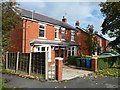
Photos of PR4 2YG
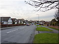
![Blackpool Road [B5192] in PR4 2YG](https://images.propbar.co.uk/images/geograph/46/90/4690117_120.jpg)
24 photos from this area
Area Information
Key information about the PR4 2YG including its size, population, and administrative classification.
- Area Type
- Postcode
- Area Size
- 5.7 hectares
- Population
- 1680
- Population Density
- 1072 people/km²
House Prices in PR4 2YG
41
Properties
£217,419
Average Sold Price
£79,995
Lowest Price
£389,000
Highest Price
Showing 41 properties
| Address | Type | Beds | Baths | Last Sale Price | Last Sale Date | |
|---|---|---|---|---|---|---|
| 35 Roman Way, Kirkham, PR4 2YG | house | - | - | £389,000 | Aug 2023 | |
| 20 Roman Way, Kirkham, PR4 2YG | Detached | 3 | 2 | £235,000 | Jul 2023 | |
| 15 Roman Way, Kirkham, PR4 2YG | Retail | 4 | 3 | £373,000 | Jul 2022 | |
| 14 Roman Way, Kirkham, PR4 2YG | house | - | - | £298,995 | Feb 2022 | |
| 29 Roman Way, Kirkham, PR4 2YG | house | - | - | £330,000 | Sep 2019 | |
| 28 Roman Way, Kirkham, PR4 2YG | house | 4 | - | £247,100 | Aug 2019 | |
| 36 Roman Way, Kirkham, PR4 2YG | house | 4 | - | £325,000 | Jan 2019 | |
| 11 Roman Way, Kirkham, PR4 2YG | Detached | 4 | 2 | £225,000 | Sep 2017 | |
| 4 Roman Way, Kirkham, PR4 2YG | Detached | 4 | 2 | £205,000 | Oct 2015 | |
| 31 Roman Way, Kirkham, PR4 2YG | Detached | 4 | - | £290,000 | Aug 2015 |
Page 1 of 5
Energy Efficiency in PR4 2YG
Amenities
Schools
| Rank | School | Type | Entry gender | Ages |
|---|
Explore more schools in this area
Go to Schools tabDemographics
Household Size
Two person
most common
Accommodation Type
Houses
most common
Tenure
88
majority
Ethnic Group
White
most common
Religion
N/A
most common
Household Composition
N/A
most common
Age
47
median
Adults (30-64 years)
most common
Household Deprivation
N/A
with no deprivation
NS-SEC
31
in Lower managerial occupations
Explore more demographic insights in this area
Go to Demographics tabPlanning
Planning Constraints
- Flood RiskPremium
- Ramsar Wetland SitesPremium
- Area of Outstanding Natural BeautyPremium
- Protected Nature ReservePremium
- Protected WoodlandPremium