Area Overview for PR4 2TN
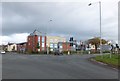
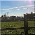
Photos of PR4 2TN


Area Information
Living in PR4 2TN means residing in a very specific residential cluster located in Lancashire. You are situated within a postcode area that covers just 813 square metres. This compact size indicates a dense, small-scale settlement rather than a sprawling suburb. The population stands at 1,538 people, creating a community where residents likely know one another. You are part of a neighbourhood defined by its small footprint and concentrated housing. Daily life here is characterised by immediate proximity to homes and neighbours rather than vast open spaces. While the area is small, it connects directly to the broader Kirkham and Wesham districts. Your location offers a distinct separation from larger commercial hubs while remaining accessible to them. The area acts as a quiet stopover for those working in nearby towns or commuting via local transport links. You should be prepared for a living environment that values proximity over extensive recreational grounds. This postcode serves as a fundamental building block in the wider rural Lancashire landscape.
- Area Type
- Postcode
- Area Size
- 813 m²
- Population
- 1538
- Population Density
- 7291 people/km²
The property market in PR4 2TN is characterised by a significant portion of owner-occupied dwellings standing at 47. This statistic indicates that nearly half of the 1,538 residents hold a stake in their homes, fostering a stable market environment with fewer short-term turnover fluctuations typical of purely rental sectors. Houses comprise the most common accommodation type, meaning you will primarily encounter detached, semi-detached, or terraced family homes rather than flats or apartments. This focus on houses affects the available footprint for plots within the 813 square metre area size covered by the postcode. Buyers looking for larger gardens or single-family units will find this postcode aligns with their expectations of traditional housing stock. The high concentration of owner-occupiers often drives local maintenance standards and community engagement regarding upkeep. There are no large housing estates or student accommodation blocks featured in this specific data set. The market here relies on the value of individual family properties. You can expect a transaction market driven by those moving between jobs or lifestyle changes rather than institutional buying or annual tenancy rotations. The housing stock is consistent with a middle-aged population seeking stability.
House Prices in PR4 2TN
Showing 4 properties
| Address | Type | Beds | Baths | Last Sale Price | Last Sale Date | |
|---|---|---|---|---|---|---|
| 3, Houghtons Court, Poplar Avenue, Kirkham, PR4 2TN | Terraced | 2 | 1 | £92,500 | May 2025 | |
| 1, Houghtons Court, Poplar Avenue, Kirkham, PR4 2TN | house | - | - | £98,500 | Mar 2021 | |
| 2, Houghtons Court, Poplar Avenue, Kirkham, PR4 2TN | house | - | - | £95,000 | May 2011 | |
| 4, Houghtons Court, Poplar Avenue, Kirkham, PR4 2TN | Flat | - | - | - | - |
Energy Efficiency in PR4 2TN
Living in PR4 2TN places you within practical reach of specific retail and transport hubs. You can shop at Morrisons Kirkham, Co-op Kirkham, and Co-op Wesham, offering a variety of supermarket and food retail options within easy driving distance. These five notable retail venues form the core of your commercial entertainment and grocery shopping routine. For commuters, the railway network is accessible via Kirkham and Wesham Railway Station, Salwick Railway Station, and Moss Side Railway Station. These five stations provide efficient rail links to Manchester and Preston, integrating you into the wider regional transport web. Warton Airport is also listed among your nearby amenities, offering one air travel option within practical reach for business or leisure. Your daily life balances the quiet of a small residential cluster with the convenience of nearby supermarkets and train stations. You have access to essential services without needing to drive into crowded urban centres. The presence of these railways and retail outlets ensures that isolation is minimal. You can combine the peace of country living with the connectivity of town facilities.
Amenities
Schools
Families considering PR4 2TN have access to Carr Hill High School, which operates as both a primary and an academy. This dual designation means you will find different educational phases housed under the same institutional name within the immediate vicinity. For primary education, Carr Hill High School serves the younger demographic, transitioning children into the academy phase of the same institution. The presence of these two distinct types offers a streamlined educational pathway for residents moving into the area. You do not need to look far outside the immediate locality to secure schooling for your children. The academy status signifies a specific charter to run the school independently, often attracting families who prefer that governance model alongside primary education provision. The data confirms the proximity of these facilities to the 813 square metre cluster of homes. Parents in PR4 2TN benefit from having their children attend an institution located steps away from their homes. This namesake school anchors the educational offer for the local community.
| Rank | School | Type | Entry gender | Ages |
|---|
Explore more schools in this area
Go to Schools tabDemographics
The community in PR4 2TN is defined by a mature demographic profile with a median age of 47 years. Most residents fall into the adult age range between 30 and 64 years, suggesting a stable, established population rather than a transient youth demographic. Home ownership is firmly entrenched with 47% of households owning their property outright or with a mortgage. This figure places the area slightly below the national average for specialist non-saver acquisition but indicates significant stability compared to high-rental zones. Houses represent the predominant accommodation type, shaping the streetscape and garden availability throughout the postcode. The predominant ethnic group is White, describing the majority of the 1,538 population counted in this sector. These statistics paint a picture of a settled community where long-term residents have invested in their local housing stock. The age distribution implies a low volume of young families moving in for primary education unless they are joining the established 30-plus demographic. You will find an environment dominated by working-age adults who have chosen to settle in this specific pocket of Lancashire.
Household Size
Accommodation Type
Tenure
Ethnic Group
Religion
Household Composition
Age
Household Deprivation
NS-SEC
Explore more demographic insights in this area
Go to Demographics tabPlanning
Planning Constraints
- Flood RiskPremium
- Ramsar Wetland SitesPremium
- Area of Outstanding Natural BeautyPremium
- Protected Nature ReservePremium
- Protected WoodlandPremium