Area Overview for PR4 2HL
Photos of PR4 2HL
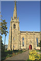
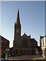
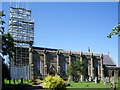
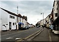
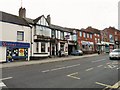
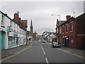
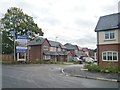
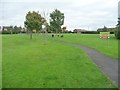
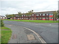
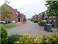
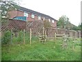
77 photos from this area
Area Information
Key information about the PR4 2HL including its size, population, and administrative classification.
- Area Type
- Postcode
- Area Size
- 3.3 hectares
- Population
- 1554
- Population Density
- 2735 people/km²
House Prices in PR4 2HL
17
Properties
£169,977
Average Sold Price
£63,000
Lowest Price
£274,000
Highest Price
Showing 17 properties
| Address | Type | Beds | Baths | Last Sale Price | Last Sale Date | |
|---|---|---|---|---|---|---|
| 11 The Coppice, Kirkham, PR4 2HL | Semi-detached | 4 | 2 | £221,000 | Dec 2022 | |
| 7 The Coppice, Kirkham, PR4 2HL | Bungalow | - | - | £190,000 | Apr 2021 | |
| 23 The Coppice, Kirkham, PR4 2HL | Bungalow | - | - | £219,950 | Nov 2020 | |
| 17 The Coppice, Kirkham, PR4 2HL | Detached | 3 | 1 | £170,000 | Nov 2020 | |
| 21 The Coppice, Kirkham, PR4 2HL | Semi-detached | 2 | 1 | £166,800 | Nov 2018 | |
| 1 The Coppice, Kirkham, PR4 2HL | Bungalow | 4 | 2 | £274,000 | Dec 2013 | |
| 5 The Coppice, Kirkham, PR4 2HL | Bungalow | - | - | £125,000 | Sep 2012 | |
| 2 The Coppice, Kirkham, PR4 2HL | Bungalow | - | - | £125,000 | Mar 2012 | |
| 4 The Coppice, Kirkham, PR4 2HL | Bungalow | - | - | £114,995 | Apr 2008 | |
| 9 The Coppice, Kirkham, PR4 2HL | Semi-detached | - | - | £200,000 | Nov 2005 |
Page 1 of 2
Energy Efficiency in PR4 2HL
Amenities
Schools
| Rank | School | Type | Entry gender | Ages |
|---|
Explore more schools in this area
Go to Schools tabDemographics
Household Size
One person
most common
Accommodation Type
Houses
most common
Tenure
56
majority
Ethnic Group
White
most common
Religion
N/A
most common
Household Composition
N/A
most common
Age
47
median
Adults (30-64 years)
most common
Household Deprivation
N/A
with no deprivation
NS-SEC
25
in Lower managerial occupations
Explore more demographic insights in this area
Go to Demographics tabPlanning
Planning Constraints
- Flood RiskPremium
- Ramsar Wetland SitesPremium
- Area of Outstanding Natural BeautyPremium
- Protected Nature ReservePremium
- Protected WoodlandPremium