Area Overview for PR4 2BG
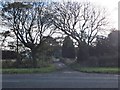
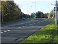
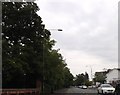
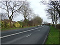
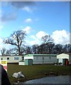
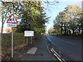
Photos of PR4 2BG

Area Information
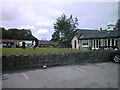
Living in PR4 2BG offers a straightforward residential experience within a tightly defined cluster in England. This specific postcode area encompasses a small population of roughly 1,680 residents, creating an intimate community feel. The housing landscape dominates the immediate surroundings, with the built environment reflecting a focus on private dwellings rather than high-density living. You will find yourself in an environment where local knowledge matters, as this represents a small residential cluster distinct from wider urban sprawl. Daily life in PR4 2BG is characterised by proximity to essential services and transport links. The area sits within Lancashire, providing easy access to the surrounding towns of Kirkham, Salwick, and Wesham without the congestion of larger city centres. The space available is limited relative to the number of people, resulting in a population density that ranks significantly higher than the national average. You will notice that movement within this specific postal code is mostly on foot or by car, given the compact nature of the development. The character of the neighbourhood relies heavily on its reliable connections to the wider region. Residents benefit from a high-quality broadband infrastructure that supports modern working patterns. While the specific boundaries of PR4 2BG are small, the practical reach of your home extends to multiple railway stations and key retail outlets. This setup suits those who value stability and established local networks over the novelty of rapid urban expansion.
- Area Type
- Postcode
- Area Size
- Not available
- Population
- 1680
- Population Density
- 1072 people/km²
The property market in PR4 2BG is distinctly defined by its composition of houses and a very high rate of home ownership. With 88% of households owned by their residents, the area functions primarily as an established owner-occupier zone rather than a dynamic letting market. This concentration indicates that the housing stock consists of dwellings that current owners have inhabited for significant periods. When you view homes in PR4 2BG, you are looking at properties where the market transaction history likely shows long-term retention rather than frequent flips. The predominance of houses over other accommodation types reinforces the character of the neighbourhood. You will not find purpose-built flats or student housing dominating the streets; instead, the fabric of the area is made up of residential properties suited to families or couples. This type of market often values structural integrity and established infrastructure over new developments. Buyers here look for houses that fit into an existing, stable community framework. Because this is a small postcode cluster covering a low population count of 1,680, the total number of properties for sale is naturally limited. The market is not characterised by volatility or dramatic price swings seen in larger metropolitan zones. Instead, it reflects a calm, steady environment where property values are tied to the specific quality of the local houses and their proximity to transport links. The 100% broadband score supports the modern requirement for reliable utilities, which is a key consideration for any buyer assessing the total cost of living before committing to a purchase in this small area.
House Prices in PR4 2BG
No properties found in this postcode.
Energy Efficiency in PR4 2BG
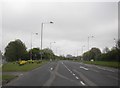
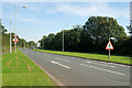
Your daily lifestyle in PR4 2BG is supported by a cluster of amenities located within easy reach. For your shopping requirements, three specific retailers are notable within the immediate vicinity: Morrisons Kirkham, Co-op Kirkham, and Spar. These locations provide you with full-range grocery options, convenience foods, and essential household supplies without the need for long travel. You can complete most errands with just 5 minutes of travel time from your home. Transport options are significantly more varied, with 5 distinct rail stations in the catchment area. Kirkham & Wesham Railway Station, Salwick Railway Station, and Moss Side Railway Station offer regular services for commuting or leisure travel around Lancashire. The presence of Warton Airport within the nearby amenities network also adds a layer of flexibility for business travel or personal trips. Having 1 major airport option nearby means you do not have to travel far to access air connections. The convenience of knowing exactly where your nearest shop or train is located adds practical value to your property choice. You are not relying on generalised statements about local services; instead, you have named venues like Spar and Morrisons Kirkham as immediate neighbours. This predictability and proximity define the rhythm of daily life here, where most necessary tasks can be completed locally or via a very short journey to a major interchange.
Amenities
Schools
| Rank | School | Type | Entry gender | Ages |
|---|
Explore more schools in this area
Go to Schools tabDemographics
The community within PR4 2BG reflects a settled and mature population. The median age is 47, indicating that the majority of residents fall into the older working-age bracket. Specifically, adults aged between 30 and 64 years make up the most common age range in this postcode. This demographic profile suggests a neighbourhood where families and established professionals have put down long-term roots rather than transient populations. Home ownership is the prevailing accommodation model here, with 88% of households owning their homes outright or with a mortgage. This high level of ownership creates a stable community where long-term reinvestment in the property is common. The remaining 12% of the population consists primarily of renters, and the rental market operates on a much smaller scale compared to the owner-occupier sector. You will find that the local housing stock is dominated by houses, ensuring a suburban or semi-rural rather than an apartment-based lifestyle. The predominant ethnic group is White, which aligns with the broader demographic picture of Lancashire. There is no data available regarding specific deprivation levels for this area, meaning you cannot assess income inequality or benefit claim rates within this specific cluster. Instead, the high homeownership rate serves as a strong indicator of financial stability among the local residents. The population density of 1,072 people per square kilometre is notably high, suggesting that individual properties are situated relatively close to one another.
Household Size
Accommodation Type
Tenure
Ethnic Group
Religion
Household Composition
Age
Household Deprivation
NS-SEC
Explore more demographic insights in this area
Go to Demographics tabPlanning
Planning Constraints
- Flood RiskPremium
- Ramsar Wetland SitesPremium
- Area of Outstanding Natural BeautyPremium
- Protected Nature ReservePremium
- Protected WoodlandPremium