Area Overview for PR4 1HS
Photos of PR4 1HS

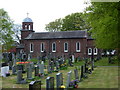
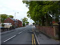
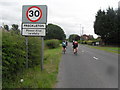
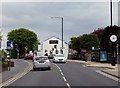

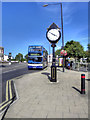
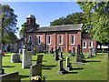

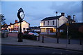
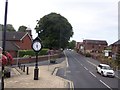
22 photos from this area
Area Information
Key information about the PR4 1HS including its size, population, and administrative classification.
- Area Type
- Postcode
- Area Size
- 35.0 hectares
- Population
- 1223
- Population Density
- 987 people/km²
House Prices in PR4 1HS
47
Properties
£129,145
Average Sold Price
£20,000
Lowest Price
£350,000
Highest Price
Showing 47 properties
| Address | Type | Beds | Baths | Last Sale Price | Last Sale Date | |
|---|---|---|---|---|---|---|
| 57 Kirkham Road, North Of Bypass, Freckleton, PR4 1HS | Terraced | 2 | 1 | £129,950 | Jun 2025 | |
| 43 Kirkham Road, North Of Bypass, Freckleton, PR4 1HS | Terraced | 2 | 1 | £163,000 | Sep 2024 | |
| 39 Kirkham Road, North Of Bypass, Freckleton, PR4 1HS | Terraced | 2 | 1 | £132,000 | Mar 2022 | |
| 83 Kirkham Road, North Of Bypass, Freckleton, PR4 1HS | house | - | - | £195,000 | Feb 2022 | |
| 51 Kirkham Road, North Of Bypass, Freckleton, PR4 1HS | Semi-detached | 3 | 1 | £188,000 | Aug 2021 | |
| 79 Kirkham Road, North Of Bypass, Freckleton, PR4 1HS | house | - | - | £183,000 | Jun 2021 | |
| 87 Kirkham Road, North Of Bypass, Freckleton, PR4 1HS | house | - | - | £182,000 | Jun 2021 | |
| 53 Kirkham Road, North Of Bypass, Freckleton, PR4 1HS | Terraced | 3 | 1 | £155,000 | May 2021 | |
| 121 Kirkham Road, North Of Bypass, Freckleton, PR4 1HS | Detached | 3 | 2 | £350,000 | Mar 2021 | |
| 5 Kirkham Road, South Of Bypass, Freckleton, PR4 1HS | Terraced | 3 | 1 | £130,000 | Oct 2020 |
Page 1 of 5
Energy Efficiency in PR4 1HS
Amenities
Schools
| Rank | School | Type | Entry gender | Ages |
|---|
Explore more schools in this area
Go to Schools tabDemographics
Household Size
Two person
most common
Accommodation Type
Houses
most common
Tenure
86
majority
Ethnic Group
White
most common
Religion
N/A
most common
Household Composition
N/A
most common
Age
47
median
Adults (30-64 years)
most common
Household Deprivation
N/A
with no deprivation
NS-SEC
34
in Lower managerial occupations
Explore more demographic insights in this area
Go to Demographics tabPlanning
Planning Constraints
- Flood RiskPremium
- Ramsar Wetland SitesPremium
- Area of Outstanding Natural BeautyPremium
- Protected Nature ReservePremium
- Protected WoodlandPremium