Area Overview for PR4 1GY
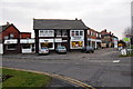
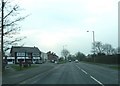
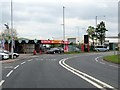
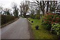
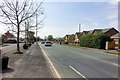
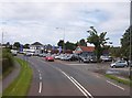
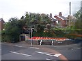
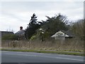
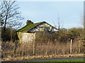
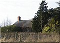
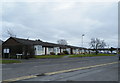
Photos of PR4 1GY

Area Information
Living in PR4 1GY offers a quiet residential experience within a compact one-and-a-half-hectare cluster. You are part of a defined community housing 2,592 people, creating a low-density environment spread across just 1.2 hectares. This specific postcode shelters a population density of 219 people per square kilometre, which explains the spacious feel compared to denser urban stretches. The area operates as a distinct neighbourhood where distance between properties may be greater but access to wider transport networks remains surprisingly strong. You will find that daily life here balances rural tranquillity with practical connectivity, avoiding the congestion typically associated with larger towns. The small geographical footprint means the community feels intimate, yet the location connects you effectively to broader regions without sacrificing peace. Homebuyers considering PR4 1GY secure a slice of residential land that prioritises space over urban intensity. The layout supports a slower pace of life while maintaining reasonable reach to essential services. This specific postal code does not offer the anonymity of sprawling suburbs but instead provides a concentrated living environment where you are part of a tangible, manageable community. The area functions as a stable residential pocket, ideal for those who value privacy alongside reliable access to roads and rail links. You can expect a setting that minimises noise while ensuring your daily journey to work or leisure destinations remains efficient.
- Area Type
- Postcode
- Area Size
- 1.2 hectares
- Population
- 2592
- Population Density
- 219 people/km²
The property market in PR4 1GY is defined largely by owner-occupation, with 81 percent of homes held by their owners. This statistic signals that the local housing stock consists mainly of established properties rather than private rentals or student accommodation. You will encounter a market driven by traditional homeownership, where buyers look to purchase freehold or leasehold houses suited to long-term living. The accommodation type is overwhelmingly houses, meaning you will not find the row of flats often seen in city centres or university towns. This focus on houses caters to families and empty nesters rather than single professionals or investors seeking rental yields. Investors or those seeking a buy-to-let property in PR4 1GY may face a竞争激烈 market, as the high ownership rate means fewer rental units are available. The 1.2-hectare size of the area further limits the number of properties on offer at any one time, making specific listings relatively scarce when they appear. Homebuyers here typically purchase to live in for the long term, which stabilises prices and reduces volatile fluctuations. The predominance of houses over flats also means that space and garden access are standard expectations. If you are looking to purchase a home in this specific postcode, your primary options remain the resale market of existing owner-occupied homes.
House Prices in PR4 1GY
Showing 24 properties
| Address | Type | Beds | Baths | Last Sale Price | Last Sale Date | |
|---|---|---|---|---|---|---|
| 3 Spire Grove, Bryning With Warton, PR4 1GY | Terraced | 3 | 2 | £213,500 | Oct 2025 | |
| 19 Spire Grove, Bryning With Warton, PR4 1GY | Detached | 5 | 3 | £359,950 | Jun 2023 | |
| 28 Spire Grove, Bryning With Warton, PR4 1GY | house | - | - | £409,950 | Jan 2023 | |
| 24 Spire Grove, Bryning With Warton, PR4 1GY | house | - | - | £234,950 | Dec 2022 | |
| 26 Spire Grove, Bryning With Warton, PR4 1GY | house | - | - | £314,950 | Dec 2022 | |
| 22 Spire Grove, Bryning With Warton, PR4 1GY | Semi-detached | 3 | 2 | £259,950 | Oct 2022 | |
| 20 Spire Grove, Bryning With Warton, PR4 1GY | house | - | - | £236,950 | Oct 2022 | |
| 18 Spire Grove, Bryning With Warton, PR4 1GY | house | - | - | £229,950 | Oct 2022 | |
| 12 Spire Grove, Bryning With Warton, PR4 1GY | house | - | - | £93,520 | Oct 2022 | |
| 16 Spire Grove, Bryning With Warton, PR4 1GY | house | - | - | £93,520 | Oct 2022 |
Energy Efficiency in PR4 1GY
Your daily lifestyle in PR4 1GY is supported by a cluster of amenities that are strictly within walking or short driving distance. Retail convenience is high, with five shops readily available, including Spar, Morrisons Daily Warton 25, and Tesco Warton. You can purchase groceries, household essentials, and fresh food without travelling far, fitting perfectly into a community that values time efficiently. For aviation enthusiasts, the proximity of Warton Airport and Blackpool International Airport adds a unique feature to the local landscape. These venues are not just for travellers but define the character of the immediate vicinity. Rail connectivity complements these retail options, with five railway stations serving the wider region. Moss Side, Kirkham & Wesham, and Lytham stations are key for commuting or day trips, integrating well with your easy access to shops. While the area is residential, the density of services ensures you do not have to travel deep into town for anything. The presence of these specific retailers and transport hubs means your Sunday grocery shopping or Tuesday commute requires minimal planning. Living in PR4 1GY offers a practical lifestyle where essential services are close by but the area retains a generally tranquil atmosphere.
Amenities
Schools
Families residing in PR4 1GY benefit from access to specific educational establishments nearby. You can count on Bryning with Warton St Paul's Church of England Primary School for early education, which serves the local catchment. A second option is Warton St Paul's Church of England Primary Academy, which holds a 'good' Ofsted rating. The presence of these two primary institutions ensures that young children living in the area have convenient access to schooling without complex commutes. Both schools follow the Church of England ethos, potentially influencing the educational philosophy within the community. This concentration of primary schools means that older children and teenagers may need to look beyond PR4 1GY for secondary education options not listed in the immediate vicinity. For parents, the proximity of these primary academies provides peace of mind regarding daily drop-offs and pick-ups. The 'good' rating of Warton St Paul's Academy adds a layer of quality assurance for potential residents with young children. Living in PR4 1GY places your youngest family members step away from the highest-rated secondary schools in wider Lancashire, but it offers solid primary provision right on your doorstep.
| Rank | School | Type | Entry gender | Ages |
|---|
Explore more schools in this area
Go to Schools tabDemographics
The community within PR4 1GY reflects a mature adult demographic, with a median age of 47 years. Residents fall predominantly into the 30 to 64-year-old age range, indicating a neighbourhood dominated by established households rather than young professionals or students. This age profile suggests a stable environment where many residents have put down deep roots in the local area. Home ownership stands at an impressive 81 percent, confirming that the vast majority of people living in PR4 1GY are the primary owners of their properties. This high rate of ownership contributes to the stability of the housing stock and a sense of long-term commitment to the location. Accommodation types are primarily houses, aligning with the preferences of this older, owner-occupying demographic. You will find that the housing stock caters to families and individuals seeking detached or semi-detached living rather than apartments or shared housing. The ethnic composition is overwhelmingly White, mirroring the broader demographic trends of the region and creating a culturally familiar environment for many. This area does not cater to a transient population; instead, it hosts a consistent group of residents who have chosen this specific postcode for its character and suitability for their life stage. The demographic data paints a picture of a settled community where neighbours likely have known each other for decades.
Household Size
Accommodation Type
Tenure
Ethnic Group
Religion
Household Composition
Age
Household Deprivation
NS-SEC
Explore more demographic insights in this area
Go to Demographics tabPlanning
Planning Constraints
- Flood RiskPremium
- Ramsar Wetland SitesPremium
- Area of Outstanding Natural BeautyPremium
- Protected Nature ReservePremium
- Protected WoodlandPremium