Area Overview for PR4 0TH
Photos of PR4 0TH
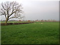
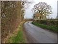
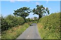
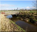
9 photos from this area
Area Information
Key information about the PR4 0TH including its size, population, and administrative classification.
- Area Type
- Postcode
- Area Size
- 38.0 hectares
- Population
- 1119
- Population Density
- 80 people/km²
House Prices in PR4 0TH
12
Properties
£549,875
Average Sold Price
£245,000
Lowest Price
£700,000
Highest Price
Showing 12 properties
| Address | Type | Beds | Baths | Last Sale Price | Last Sale Date | |
|---|---|---|---|---|---|---|
| The Laurels, Cinder Lane, Preston, PR4 0TH | Detached | 4 | 3 | £670,000 | Nov 2023 | |
| The Willows, Cinder Lane, Preston, PR4 0TH | house | 4 | 2 | £685,000 | Mar 2023 | |
| The Oaks, Cinder Lane, Preston, PR4 0TH | house | 4 | 2 | £700,000 | Dec 2022 | |
| Lewth Lodge, Cinder Lane, Preston, PR4 0TH | house | - | - | £540,000 | Aug 2021 | |
| Lewth House Farm, Cinder Lane, Preston, PR4 0TH | house | - | - | £629,000 | Mar 2021 | |
| Clinkers, Cinder Lane, Preston, PR4 0TH | house | 5 | - | £650,000 | Dec 2020 | |
| East View Barn, Cinder Lane, Preston, PR4 0TH | house | 2 | 2 | £280,000 | Oct 2019 | |
| Lavender Cottage, Cinder Lane, Preston, PR4 0TH | house | - | - | £245,000 | Apr 2011 | |
| The Old Orchard, Cinder Lane, Preston, PR4 0TH | Detached | 5 | 3 | - | - | |
| The Croft, Cinder Lane, Preston, PR4 0TH | Retail | 4 | 2 | - | - |
Page 1 of 2
Energy Efficiency in PR4 0TH
Amenities
Schools
| Rank | School | Type | Entry gender | Ages |
|---|
Explore more schools in this area
Go to Schools tabDemographics
Household Size
Two person
most common
Accommodation Type
Houses
most common
Tenure
85
majority
Ethnic Group
White
most common
Religion
N/A
most common
Household Composition
N/A
most common
Age
47
median
Adults (30-64 years)
most common
Household Deprivation
N/A
with no deprivation
NS-SEC
38
in Lower managerial occupations
Explore more demographic insights in this area
Go to Demographics tabPlanning
Planning Constraints
- Flood RiskPremium
- Ramsar Wetland SitesPremium
- Area of Outstanding Natural BeautyPremium
- Protected Nature ReservePremium
- Protected WoodlandPremium