Area Overview for PR4 0PW
Photos of PR4 0PW
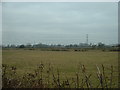
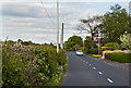
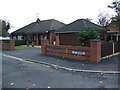
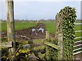
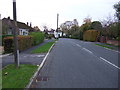
5 photos from this area
Area Information
Key information about the PR4 0PW including its size, population, and administrative classification.
- Area Type
- Postcode
- Area Size
- 13.1 hectares
- Population
- 1119
- Population Density
- 80 people/km²
House Prices in PR4 0PW
65
Properties
£274,330
Average Sold Price
£199,750
Lowest Price
£426,750
Highest Price
Showing 65 properties
| Address | Type | Beds | Baths | Last Sale Price | Last Sale Date | |
|---|---|---|---|---|---|---|
| 122 Buckthorn Drive, Preston, PR4 0PW | Detached | 3 | 2 | £275,000 | Jul 2025 | |
| 124 Buckthorn Drive, Preston, PR4 0PW | Detached | 4 | 2 | £300,000 | Feb 2025 | |
| 100 Buckthorn Drive, Preston, PR4 0PW | Detached | 4 | 2 | £362,500 | Jan 2025 | |
| 128 Buckthorn Drive, Preston, PR4 0PW | house | - | - | £271,750 | Feb 2024 | |
| 118 Buckthorn Drive, Preston, PR4 0PW | house | - | - | £360,750 | Apr 2023 | |
| 114 Buckthorn Drive, Preston, PR4 0PW | house | - | - | £356,750 | Apr 2023 | |
| 126 Buckthorn Drive, Preston, PR4 0PW | house | - | - | £267,750 | Apr 2023 | |
| 110 Buckthorn Drive, Preston, PR4 0PW | Detached | 4 | - | £255,750 | Apr 2023 | |
| 102 Buckthorn Drive, Preston, PR4 0PW | house | - | - | £426,750 | Feb 2023 | |
| 116 Buckthorn Drive, Preston, PR4 0PW | house | - | - | £365,750 | Feb 2023 |
Page 1 of 7
Energy Efficiency in PR4 0PW
Amenities
Schools
| Rank | School | Type | Entry gender | Ages |
|---|
Explore more schools in this area
Go to Schools tabDemographics
Household Size
Two person
most common
Accommodation Type
Houses
most common
Tenure
85
majority
Ethnic Group
White
most common
Religion
N/A
most common
Household Composition
N/A
most common
Age
47
median
Adults (30-64 years)
most common
Household Deprivation
N/A
with no deprivation
NS-SEC
38
in Lower managerial occupations
Explore more demographic insights in this area
Go to Demographics tabPlanning
Planning Constraints
- Flood RiskPremium
- Ramsar Wetland SitesPremium
- Area of Outstanding Natural BeautyPremium
- Protected Nature ReservePremium
- Protected WoodlandPremium