Area Overview for PR4 0HB
Photos of PR4 0HB
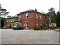
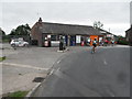
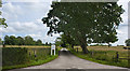

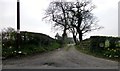
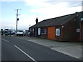
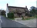
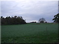
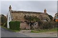
12 photos from this area
Area Information
Key information about the PR4 0HB including its size, population, and administrative classification.
- Area Type
- Postcode
- Area Size
- 67.4 hectares
- Population
- 1119
- Population Density
- 80 people/km²
House Prices in PR4 0HB
36
Properties
£378,886
Average Sold Price
£99,000
Lowest Price
£1,332,902
Highest Price
Showing 36 properties
| Address | Type | Beds | Baths | Last Sale Price | Last Sale Date | |
|---|---|---|---|---|---|---|
| Barnfield Cottage, Rosemary Lane, Preston, PR4 0HB | Detached | 4 | 1 | £450,000 | May 2022 | |
| Applegarth, Rosemary Lane, Preston, PR4 0HB | house | 2 | - | £515,000 | Oct 2021 | |
| Barnfield Coach House, Rosemary Lane, Preston, PR4 0HB | office_workshop | - | - | £1,332,902 | Jun 2021 | |
| Bartle Hall Farm Cottage, Rosemary Lane, Preston, PR4 0HB | house | - | - | £207,500 | Jul 2019 | |
| The Croft, Rosemary Lane, Preston, PR4 0HB | Cottage | 2 | 1 | £275,000 | Apr 2019 | |
| Heatherdene, Rosemary Lane, Preston, PR4 0HB | Semi-detached | 3 | 1 | £230,000 | Dec 2018 | |
| Myrtle House, Rosemary Lane, Preston, PR4 0HB | Bungalow | 3 | 1 | £362,500 | Nov 2018 | |
| Swillbrook House, Rosemary Lane, Preston, PR4 0HB | hospital_care_home | - | - | £375,000 | Dec 2015 | |
| Winks Barn, Rosemary Lane, Preston, PR4 0HB | Detached | 4 | 3 | £562,500 | Oct 2014 | |
| Glengarry, Rosemary Lane, Preston, PR4 0HB | Semi-detached | 3 | 2 | £150,000 | May 2006 |
Page 1 of 4
Energy Efficiency in PR4 0HB
Amenities
Schools
| Rank | School | Type | Entry gender | Ages |
|---|
Explore more schools in this area
Go to Schools tabDemographics
Household Size
Two person
most common
Accommodation Type
Houses
most common
Tenure
85
majority
Ethnic Group
White
most common
Religion
N/A
most common
Household Composition
N/A
most common
Age
47
median
Adults (30-64 years)
most common
Household Deprivation
N/A
with no deprivation
NS-SEC
38
in Lower managerial occupations
Explore more demographic insights in this area
Go to Demographics tabPlanning
Planning Constraints
- Flood RiskPremium
- Ramsar Wetland SitesPremium
- Area of Outstanding Natural BeautyPremium
- Protected Nature ReservePremium
- Protected WoodlandPremium