Area Overview for PR4 0AS
Photos of PR4 0AS

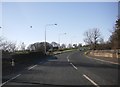


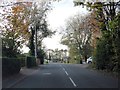
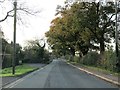
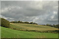
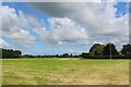
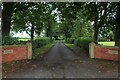


21 photos from this area
Area Information
Key information about the PR4 0AS including its size, population, and administrative classification.
- Area Type
- Postcode
- Area Size
- 91.9 hectares
- Population
- 2137
- Population Density
- 140 people/km²
House Prices in PR4 0AS
24
Properties
£340,750
Average Sold Price
£140,000
Lowest Price
£770,000
Highest Price
Showing 24 properties
| Address | Type | Beds | Baths | Last Sale Price | Last Sale Date | |
|---|---|---|---|---|---|---|
| Holly Bank, Newsham Hall Lane, Preston, PR4 0AS | house | - | - | £377,500 | Dec 2020 | |
| Crowhall Farm, Newsham Hall Lane, Preston, PR4 0AS | house | 3 | - | £300,000 | Dec 2020 | |
| North Dene, Newsham Hall Lane, Preston, PR4 0AS | house | - | - | £220,000 | Aug 2016 | |
| Westbourne, Newsham Hall Lane, Preston, PR4 0AS | Detached | 4 | 2 | £350,000 | Mar 2016 | |
| Greenfields, Newsham Hall Lane, Preston, PR4 0AS | house | 3 | - | £265,000 | May 2013 | |
| Oakwood, Newsham Hall Lane, Preston, PR4 0AS | house | - | - | £354,000 | Aug 2008 | |
| Poppy Field, Newsham Hall Lane, Preston, PR4 0AS | Detached | - | - | £316,000 | Aug 2006 | |
| Westfield, Newsham Hall Lane, Preston, PR4 0AS | Semi-detached | - | - | £140,000 | Nov 2004 | |
| Grove House, Newsham Hall Lane, Preston, PR4 0AS | Detached | - | - | £770,000 | Aug 2004 | |
| Hasely House, Newsham Hall Lane, Preston, PR4 0AS | Detached | 4 | 3 | £315,000 | Mar 2004 |
Page 1 of 3
Energy Efficiency in PR4 0AS
Amenities
Schools
| Rank | School | Type | Entry gender | Ages |
|---|
Explore more schools in this area
Go to Schools tabDemographics
Household Size
Family (3-5 people)
most common
Accommodation Type
Houses
most common
Tenure
94
majority
Ethnic Group
White
most common
Religion
N/A
most common
Household Composition
N/A
most common
Age
47
median
Adults (30-64 years)
most common
Household Deprivation
N/A
with no deprivation
NS-SEC
51
in Lower managerial occupations
Explore more demographic insights in this area
Go to Demographics tabPlanning
Planning Constraints
- Flood RiskPremium
- Ramsar Wetland SitesPremium
- Area of Outstanding Natural BeautyPremium
- Protected Nature ReservePremium
- Protected WoodlandPremium