Area Overview for PR3 2NG
Photos of PR3 2NG
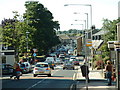
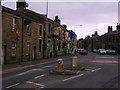
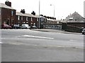
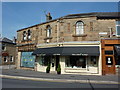
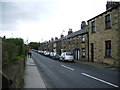
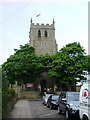
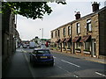
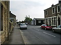
100 photos from this area
Area Information
Key information about the PR3 2NG including its size, population, and administrative classification.
- Area Type
- Postcode
- Area Size
- 1.8 hectares
- Population
- 1289
- Population Density
- 310 people/km²
House Prices in PR3 2NG
32
Properties
£249,873
Average Sold Price
£185,250
Lowest Price
£354,995
Highest Price
Showing 32 properties
| Address | Type | Beds | Baths | Last Sale Price | Last Sale Date | |
|---|---|---|---|---|---|---|
| 1 Fuchsia Way, Longridge, PR3 2NG | Semi-detached | 3 | 2 | £247,500 | Jan 2025 | |
| 47 Fuchsia Way, Longridge, PR3 2NG | house | - | - | £185,250 | Jan 2024 | |
| 43 Fuchsia Way, Longridge, PR3 2NG | Terraced | 2 | 1 | £213,995 | Apr 2023 | |
| 45 Fuchsia Way, Longridge, PR3 2NG | Terraced | 2 | 1 | £210,995 | Apr 2023 | |
| 49 Fuchsia Way, Longridge, PR3 2NG | house | - | - | £203,295 | Apr 2023 | |
| 35 Fuchsia Way, Longridge, PR3 2NG | house | - | - | £316,995 | Mar 2023 | |
| 59 Fuchsia Way, Longridge, PR3 2NG | house | - | - | £354,995 | Feb 2023 | |
| 27 Fuchsia Way, Longridge, PR3 2NG | Semi-detached | 3 | 2 | £221,495 | Sep 2022 | |
| 21 Fuchsia Way, Longridge, PR3 2NG | house | - | - | £332,995 | Sep 2022 | |
| 23 Fuchsia Way, Longridge, PR3 2NG | house | - | - | £221,495 | Sep 2022 |
Page 1 of 4
Energy Efficiency in PR3 2NG
Amenities
Schools
| Rank | School | Type | Entry gender | Ages |
|---|
Explore more schools in this area
Go to Schools tabDemographics
Household Size
Two person
most common
Accommodation Type
Houses
most common
Tenure
79
majority
Ethnic Group
White
most common
Religion
N/A
most common
Household Composition
N/A
most common
Age
47
median
Adults (30-64 years)
most common
Household Deprivation
N/A
with no deprivation
NS-SEC
41
in Lower managerial occupations
Explore more demographic insights in this area
Go to Demographics tabPlanning
Planning Constraints
- Flood RiskPremium
- Ramsar Wetland SitesPremium
- Area of Outstanding Natural BeautyPremium
- Protected Nature ReservePremium
- Protected WoodlandPremium