Area Overview for PR3 2DT
Photos of PR3 2DT
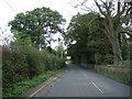
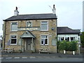
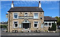
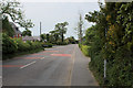

27 photos from this area
Area Information
Key information about the PR3 2DT including its size, population, and administrative classification.
- Area Type
- Postcode
- Area Size
- 1810 m²
- Population
- 2473
- Population Density
- 57 people/km²
House Prices in PR3 2DT
40
Properties
£244,885
Average Sold Price
£130,600
Lowest Price
£454,995
Highest Price
Showing 40 properties
| Address | Type | Beds | Baths | Last Sale Price | Last Sale Date | |
|---|---|---|---|---|---|---|
| 85 Bainbridge Road, Preston, PR3 2DT | house | - | - | £213,750 | Jun 2025 | |
| 83 Bainbridge Road, Preston, PR3 2DT | house | - | - | £237,500 | Jun 2025 | |
| 1 Bainbridge Road, Preston, PR3 2DT | Detached | - | - | £130,973 | May 2025 | |
| 5 Bainbridge Road, Preston, PR3 2DT | Detached | - | - | £130,972 | May 2025 | |
| 3 Bainbridge Road, Preston, PR3 2DT | Detached | - | - | £130,973 | May 2025 | |
| 93 Bainbridge Road, Preston, PR3 2DT | house | - | - | £213,750 | Feb 2025 | |
| 91 Bainbridge Road, Preston, PR3 2DT | house | - | - | £223,250 | Feb 2025 | |
| 67 Bainbridge Road, Preston, PR3 2DT | Terraced | 2 | 1 | £130,600 | Jun 2024 | |
| 99 Bainbridge Road, Preston, PR3 2DT | Semi-detached | 3 | 2 | £250,000 | Jun 2024 | |
| 73 Bainbridge Road, Preston, PR3 2DT | house | - | - | £170,800 | May 2024 |
Page 1 of 4
Energy Efficiency in PR3 2DT
Amenities
Schools
| Rank | School | Type | Entry gender | Ages |
|---|
Explore more schools in this area
Go to Schools tabDemographics
Household Size
Two person
most common
Accommodation Type
Houses
most common
Tenure
86
majority
Ethnic Group
White
most common
Religion
N/A
most common
Household Composition
N/A
most common
Age
47
median
Adults (30-64 years)
most common
Household Deprivation
N/A
with no deprivation
NS-SEC
41
in Lower managerial occupations
Explore more demographic insights in this area
Go to Demographics tabPlanning
Planning Constraints
- Flood RiskPremium
- Ramsar Wetland SitesPremium
- Area of Outstanding Natural BeautyPremium
- Protected Nature ReservePremium
- Protected WoodlandPremium