Area Overview for PR3 1TQ
Photos of PR3 1TQ
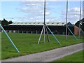
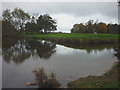
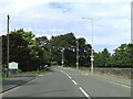
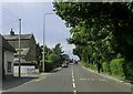
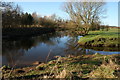
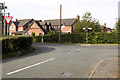
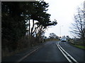
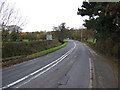
19 photos from this area
Area Information
Key information about the PR3 1TQ including its size, population, and administrative classification.
- Area Type
- Postcode
- Area Size
- 1.9 hectares
- Population
- 2749
- Population Density
- 301 people/km²
House Prices in PR3 1TQ
37
Properties
£291,165
Average Sold Price
£7,455
Lowest Price
£469,000
Highest Price
Showing 37 properties
| Address | Type | Beds | Baths | Last Sale Price | Last Sale Date | |
|---|---|---|---|---|---|---|
| 21 Nightingale Way, Catterall, PR3 1TQ | Detached | 5 | 4 | £465,000 | Feb 2025 | |
| 14 Nightingale Way, Catterall, PR3 1TQ | Detached | 5 | 3 | £450,000 | Oct 2022 | |
| 22 Nightingale Way, Catterall, PR3 1TQ | Detached | 5 | 2 | £336,500 | Mar 2022 | |
| 33 Nightingale Way, Catterall, PR3 1TQ | Detached | 5 | 2 | £330,000 | Mar 2022 | |
| 35 Nightingale Way, Catterall, PR3 1TQ | house | - | - | £317,500 | Sep 2021 | |
| 26 Nightingale Way, Catterall, PR3 1TQ | Detached | 5 | 1 | £332,500 | Jun 2021 | |
| 31 Nightingale Way, Catterall, PR3 1TQ | house | - | - | £269,995 | May 2021 | |
| 28 Nightingale Way, Catterall, PR3 1TQ | Detached | 4 | 3 | £322,250 | Mar 2021 | |
| 16 Nightingale Way, Catterall, PR3 1TQ | house | 5 | 4 | £7,455 | Mar 2021 | |
| 39 Nightingale Way, Catterall, PR3 1TQ | Detached | 3 | 2 | £235,000 | Feb 2021 |
Page 1 of 4
Energy Efficiency in PR3 1TQ
Amenities
Schools
| Rank | School | Type | Entry gender | Ages |
|---|
Explore more schools in this area
Go to Schools tabDemographics
Household Size
Two person
most common
Accommodation Type
Houses
most common
Tenure
85
majority
Ethnic Group
White
most common
Religion
N/A
most common
Household Composition
N/A
most common
Age
47
median
Adults (30-64 years)
most common
Household Deprivation
N/A
with no deprivation
NS-SEC
38
in Lower managerial occupations
Explore more demographic insights in this area
Go to Demographics tabPlanning
Planning Constraints
- Flood RiskPremium
- Ramsar Wetland SitesPremium
- Area of Outstanding Natural BeautyPremium
- Protected Nature ReservePremium
- Protected WoodlandPremium