Area Overview for PR3 1NS
Photos of PR3 1NS
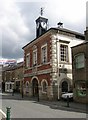
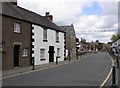
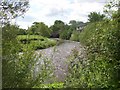
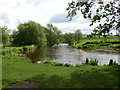
100 photos from this area
Area Information
Key information about the PR3 1NS including its size, population, and administrative classification.
- Area Type
- Postcode
- Area Size
- 2632 m²
- Population
- 1610
- Population Density
- 2057 people/km²
House Prices in PR3 1NS
8
Properties
£101,250
Average Sold Price
£65,000
Lowest Price
£137,500
Highest Price
Showing 8 properties
| Address | Type | Beds | Baths | Last Sale Price | Last Sale Date | |
|---|---|---|---|---|---|---|
| Walkers Court Dentist, 5-6 Rope Walk, Garstang, PR3 1NS | Flat | - | - | £137,500 | Nov 2020 | |
| 4 Rope Walk, Garstang, PR3 1NS | Flat | - | - | £65,000 | Aug 1999 | |
| 3 Rope Walk, Garstang, PR3 1NS | Flat | 2 | 1 | - | - | |
| 7A Rope Walk, Garstang, PR3 1NS | Flat | - | - | - | - | |
| 7 Rope Walk, Garstang, PR3 1NS | Office | - | - | - | - | |
| Dewhurst Construction Ltd, 1 Rope Walk, Garstang, PR3 1NS | Office | - | - | - | - | |
| Windsor Park Management, Abacus House, 8-9 Rope Walk, Garstang, PR3 1NS | office_workshop | - | - | - | - | |
| Walkers Dental Practice, 3-6 Rope Walk, Garstang, PR3 1NS | primary_healthcare | - | - | - | - |
Energy Efficiency in PR3 1NS
Amenities
Schools
| Rank | School | Type | Entry gender | Ages |
|---|
Explore more schools in this area
Go to Schools tabDemographics
Household Size
Two person
most common
Accommodation Type
Houses
most common
Tenure
77
majority
Ethnic Group
White
most common
Religion
N/A
most common
Household Composition
N/A
most common
Age
47
median
Elderly (65+ years)
most common
Household Deprivation
N/A
with no deprivation
NS-SEC
38
in Lower managerial occupations
Explore more demographic insights in this area
Go to Demographics tabPlanning
Planning Constraints
- Flood RiskPremium
- Ramsar Wetland SitesPremium
- Area of Outstanding Natural BeautyPremium
- Protected Nature ReservePremium
- Protected WoodlandPremium