Area Overview for PR3 1GR
Photos of PR3 1GR
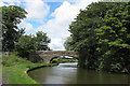
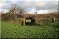
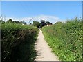
![Lancaster Canal [site of Garstang Station] in PR3 1GR](https://images.propbar.co.uk/images/geograph/01/18/11804_120.jpg)

64 photos from this area
Area Information
Key information about the PR3 1GR including its size, population, and administrative classification.
- Area Type
- Postcode
- Area Size
- 3.4 hectares
- Population
- 2424
- Population Density
- 121 people/km²
House Prices in PR3 1GR
28
Properties
£258,997
Average Sold Price
£83,876
Lowest Price
£534,995
Highest Price
Showing 28 properties
| Address | Type | Beds | Baths | Last Sale Price | Last Sale Date | |
|---|---|---|---|---|---|---|
| 31 Meadow Drive, Barnacre With Bonds, PR3 1GR | Detached | 4 | 2 | £430,000 | Oct 2025 | |
| 33 Meadow Drive, Barnacre With Bonds, PR3 1GR | Detached | 4 | - | £470,000 | Sep 2024 | |
| 22 Meadow Drive, Barnacre With Bonds, PR3 1GR | house | 4 | - | £379,995 | Dec 2021 | |
| 20 Meadow Drive, Barnacre With Bonds, PR3 1GR | Detached | 3 | 1 | £324,995 | Nov 2021 | |
| 29 Meadow Drive, Barnacre With Bonds, PR3 1GR | Detached | 4 | 2 | £448,950 | Oct 2021 | |
| 18 Meadow Drive, Barnacre With Bonds, PR3 1GR | house | - | - | £369,995 | Sep 2021 | |
| 12 Meadow Drive, Barnacre With Bonds, PR3 1GR | house | - | - | £162,797 | Jun 2021 | |
| 14 Meadow Drive, Barnacre With Bonds, PR3 1GR | house | - | - | £162,797 | Jun 2021 | |
| 27 Meadow Drive, Barnacre With Bonds, PR3 1GR | house | - | - | £162,797 | Jun 2021 | |
| 21 Meadow Drive, Barnacre With Bonds, PR3 1GR | house | - | - | £119,279 | Jun 2021 |
Page 1 of 3
Energy Efficiency in PR3 1GR
Amenities
Schools
| Rank | School | Type | Entry gender | Ages |
|---|
Explore more schools in this area
Go to Schools tabDemographics
Household Size
Two person
most common
Accommodation Type
Houses
most common
Tenure
82
majority
Ethnic Group
White
most common
Religion
N/A
most common
Household Composition
N/A
most common
Age
47
median
Adults (30-64 years)
most common
Household Deprivation
N/A
with no deprivation
NS-SEC
44
in Lower managerial occupations
Explore more demographic insights in this area
Go to Demographics tabPlanning
Planning Constraints
- Flood RiskPremium
- Ramsar Wetland SitesPremium
- Area of Outstanding Natural BeautyPremium
- Protected Nature ReservePremium
- Protected WoodlandPremium