Area Overview for PR3 0JU
Photos of PR3 0JU
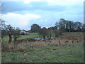
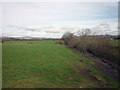
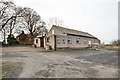
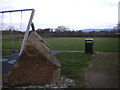
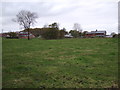
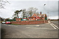
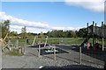
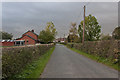
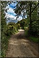
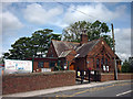
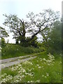
15 photos from this area
Area Information
Key information about the PR3 0JU including its size, population, and administrative classification.
- Area Type
- Postcode
- Area Size
- 1.2 km²
- Population
- 2628
- Population Density
- 75 people/km²
House Prices in PR3 0JU
30
Properties
£269,438
Average Sold Price
£120,000
Lowest Price
£400,000
Highest Price
Showing 30 properties
| Address | Type | Beds | Baths | Last Sale Price | Last Sale Date | |
|---|---|---|---|---|---|---|
| Patten House, Park Lane, Winmarleigh, PR3 0JU | Detached | 5 | 2 | £368,000 | Feb 2021 | |
| 2, Lane End Cottages, Park Lane, Winmarleigh, PR3 0JU | house | - | - | £295,000 | Apr 2018 | |
| The Pottery, Park Lane, Winmarleigh, PR3 0JU | Bungalow | - | - | £367,500 | Feb 2018 | |
| Rose Cottage, Park Lane, Winmarleigh, PR3 0JU | house | - | - | £250,000 | Sep 2011 | |
| Long Meadows, Park Lane, Winmarleigh, PR3 0JU | Detached | 2 | 2 | £400,000 | Oct 2009 | |
| Garswyn, Park Lane, Winmarleigh, PR3 0JU | Detached | - | - | £224,000 | Mar 2002 | |
| 3, Lane End Cottages, Park Lane, Winmarleigh, PR3 0JU | house | - | - | £131,000 | Oct 2000 | |
| Blackpool Cottage, Park Lane, Winmarleigh, PR3 0JU | house | - | - | £120,000 | Jul 2000 | |
| 1, Lane End Cottages, Park Lane, Winmarleigh, PR3 0JU | Terraced | 4 | - | - | - | |
| Bungalow, Smithy Lane Farm, Park Lane, Winmarleigh, PR3 0JU | Semi-detached | - | - | - | - |
Page 1 of 3
Energy Efficiency in PR3 0JU
Amenities
Schools
| Rank | School | Type | Entry gender | Ages |
|---|
Explore more schools in this area
Go to Schools tabDemographics
Household Size
Two person
most common
Accommodation Type
Houses
most common
Tenure
82
majority
Ethnic Group
White
most common
Religion
N/A
most common
Household Composition
N/A
most common
Age
47
median
Adults (30-64 years)
most common
Household Deprivation
N/A
with no deprivation
NS-SEC
34
in Lower managerial occupations
Explore more demographic insights in this area
Go to Demographics tabPlanning
Planning Constraints
- Flood RiskPremium
- Ramsar Wetland SitesPremium
- Area of Outstanding Natural BeautyPremium
- Protected Nature ReservePremium
- Protected WoodlandPremium