Area Overview for PR26 9HU
Photos of PR26 9HU
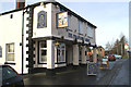
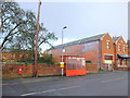
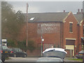

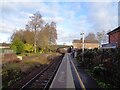


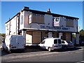

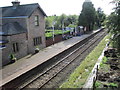
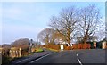
21 photos from this area
Area Information
Key information about the PR26 9HU including its size, population, and administrative classification.
- Area Type
- Postcode
- Area Size
- 8752 m²
- Population
- 1640
- Population Density
- 2694 people/km²
House Prices in PR26 9HU
22
Properties
£168,050
Average Sold Price
£95,000
Lowest Price
£245,000
Highest Price
Showing 22 properties
| Address | Type | Beds | Baths | Last Sale Price | Last Sale Date | |
|---|---|---|---|---|---|---|
| 17 Pear Tree Road, Croston, PR26 9HU | Semi-detached | 3 | 2 | £245,000 | Oct 2024 | |
| 3 Pear Tree Road, Croston, PR26 9HU | house | - | - | £205,000 | Jul 2021 | |
| 15 Pear Tree Road, Croston, PR26 9HU | house | - | - | £197,500 | Mar 2021 | |
| 5 Pear Tree Road, Croston, PR26 9HU | Semi-detached | 3 | 1 | £165,000 | Nov 2019 | |
| 13 Pear Tree Road, Croston, PR26 9HU | house | - | - | £112,500 | Apr 2015 | |
| 9 Pear Tree Road, Croston, PR26 9HU | Semi-detached | 3 | 1 | £162,000 | Jun 2014 | |
| 18 Pear Tree Road, Croston, PR26 9HU | house | 3 | 1 | £95,000 | Nov 2010 | |
| 20 Pear Tree Road, Croston, PR26 9HU | house | - | - | £164,000 | Mar 2010 | |
| 7 Pear Tree Road, Croston, PR26 9HU | house | - | - | £191,500 | Mar 2008 | |
| 6 Pear Tree Road, Croston, PR26 9HU | Semi-detached | - | - | £143,000 | Dec 2004 |
Page 1 of 3
Energy Efficiency in PR26 9HU
Amenities
Schools
| Rank | School | Type | Entry gender | Ages |
|---|
Explore more schools in this area
Go to Schools tabDemographics
Household Size
Two person
most common
Accommodation Type
Houses
most common
Tenure
72
majority
Ethnic Group
White
most common
Religion
N/A
most common
Household Composition
N/A
most common
Age
47
median
Adults (30-64 years)
most common
Household Deprivation
N/A
with no deprivation
NS-SEC
40
in Lower managerial occupations
Explore more demographic insights in this area
Go to Demographics tabPlanning
Planning Constraints
- Flood RiskPremium
- Ramsar Wetland SitesPremium
- Area of Outstanding Natural BeautyPremium
- Protected Nature ReservePremium
- Protected WoodlandPremium