Area Overview for PR26 7AT
Photos of PR26 7AT


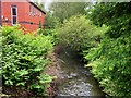
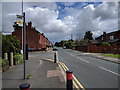


24 photos from this area
Area Information
Key information about the PR26 7AT including its size, population, and administrative classification.
- Area Type
- Postcode
- Area Size
- 7.2 hectares
- Population
- 1513
- Population Density
- 1410 people/km²
House Prices in PR26 7AT
71
Properties
£174,929
Average Sold Price
£33,250
Lowest Price
£390,000
Highest Price
Showing 71 properties
| Address | Type | Beds | Baths | Last Sale Price | Last Sale Date | |
|---|---|---|---|---|---|---|
| 72 Fossdale Moss, Moss Side, Leyland, PR26 7AT | Bungalow | 3 | 2 | £215,000 | Aug 2025 | |
| 38 Fossdale Moss, Moss Side, Leyland, PR26 7AT | Bungalow | 3 | 2 | £300,000 | Feb 2025 | |
| 116 Fossdale Moss, Moss Side, Leyland, PR26 7AT | Bungalow | 3 | 2 | £297,000 | Dec 2024 | |
| 68 Fossdale Moss, Moss Side, Leyland, PR26 7AT | Detached | 4 | 2 | £297,000 | Jul 2024 | |
| 2 Fossdale Moss, Moss Side, Leyland, PR26 7AT | Detached | 2 | 1 | £155,000 | Apr 2024 | |
| 22 Fossdale Moss, Moss Side, Leyland, PR26 7AT | Bungalow | 2 | 1 | £190,250 | Aug 2023 | |
| 132 Fossdale Moss, Moss Side, Leyland, PR26 7AT | Detached | 5 | 3 | £390,000 | Aug 2023 | |
| 90 Fossdale Moss, Moss Side, Leyland, PR26 7AT | Bungalow | 3 | 2 | £220,000 | Feb 2023 | |
| 4 Fossdale Moss, Moss Side, Leyland, PR26 7AT | Semi-detached | 6 | 3 | £180,000 | Dec 2022 | |
| 40 Fossdale Moss, Moss Side, Leyland, PR26 7AT | house | 4 | - | £270,000 | Dec 2022 |
Page 1 of 8
Energy Efficiency in PR26 7AT
Amenities
Schools
| Rank | School | Type | Entry gender | Ages |
|---|
Explore more schools in this area
Go to Schools tabDemographics
Household Size
Two person
most common
Accommodation Type
Houses
most common
Tenure
87
majority
Ethnic Group
White
most common
Religion
N/A
most common
Household Composition
N/A
most common
Age
47
median
Adults (30-64 years)
most common
Household Deprivation
N/A
with no deprivation
NS-SEC
34
in Lower managerial occupations
Explore more demographic insights in this area
Go to Demographics tabPlanning
Planning Constraints
- Flood RiskPremium
- Ramsar Wetland SitesPremium
- Area of Outstanding Natural BeautyPremium
- Protected Nature ReservePremium
- Protected WoodlandPremium