Area Overview for PR26 6TT
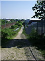
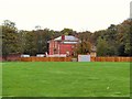
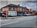
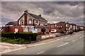
Photos of PR26 6TT


Area Information
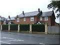
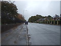
PR26 6TT represents a small, defined residential cluster in England, measuring just 7,996 square metres of land. This compact footprint houses a population of 1,699 people, creating an environment where neighbours are inevitably on familiar terms. Living in PR26 6TT means choosing a settlement with a tightly knit structure rather than a sprawling suburban sprawl. The area functions as a concentrated living space where the limitations of size contribute to a distinct sense of locality. You can expect a community where daily interactions are frequent due to the high density relative to the land available. The postcode covers a specific slice of the broader region, offering a contained slice of life away from the wider sprawl. For those looking for a home in a setting that prioritises proximity to residents over extensive green corridors, this area delivers exactly that. The character here is defined by its scale; you are not building into a vast landscape but are instead within a close-knit pocket of the countryside.
- Area Type
- Postcode
- Area Size
- 7996 m²
- Population
- 1699
- Population Density
- 443 people/km²
Buying homes in PR26 6TT requires understanding a market driven by long-term ownership rather than short-term rentals. The evidence shows that 89% of the population are home owners, indicating a strong market for owner-occupied properties. Houses constitute the main accommodation type, meaning you will find traditional detached, semi-detached, or terraced structures rather than apartment blocks or shared flats. This high level of ownership typically implies that streets are established and the housing stock is likely to be well-maintained by its owners. If you are looking for rental investment opportunities in this specific postcode, the market is already saturated with existing owners, which can limit the supply of available tenanted units. The area caters to buyers seeking a permanent residence in a smaller settlement. The dominance of houses over flat living aligns with the specific needs of the local demographic. You can expect a property market focused on family homes and established residences rather than modern conversion flats or studio apartments.
House Prices in PR26 6TT
Showing 2 properties
| Address | Type | Beds | Baths | Last Sale Price | Last Sale Date | |
|---|---|---|---|---|---|---|
| Gatehouse Office 4, Lancashire Enterprise Business Park, Centurion Way, Farington, PR26 6TT | Office | - | - | - | - | |
| Intramast Uk Ltd, Edcrest Ltd Off, Centurion Way, Farington, PR26 6TT | warehouse | - | - | - | - |
Energy Efficiency in PR26 6TT
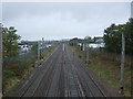
Access to amenities in PR26 6TT relies on practical reach to surrounding towns and villages rather than facilities inside the small cluster itself. You can find five retail options within a short drive, including Morrisons Seven, Tesco Leyland, and Morrisons Daily. These larger supermarkets offer the fresh food and household essentials you need without leaving the immediate vicinity. There are also five railway stations easily reachable for commuting, including Leyland Railway Station, Lostock Hall Railway Station, and Bamber Bridge Railway Station. These transport hubs provide regular links to the main line, making travel to Manchester and other business centres manageable. Daily life combines the convenience of nearby high-street shopping with the reliability of rail connections. You do not need to travel far for groceries, yet you have fast rail links when you must go further. This balance ensures that the small size of PR26 6TT does not result in a lack of essential conveniences for day-to-day living.
Amenities
Schools
Families considering schools near PR26 6TT have one primary option that is well-regarded locally. You have access to Farington Moss St. Paul's C.E. Primary School, which holds a 'good' Ofsted rating. This school provides primary education for children in the immediate vicinity of the postcode. Given the limited number of listed educational institutions, there is no secondary school data provided for this specific cluster. The presence of a primary school with a positive rating suggests that younger families can secure foundation education locally without needing extensive travel for the early years. You may need to look further afield for secondary education options, as the data does not list any colleges or high schools within practical reach of this residential cluster. The reliance on a single named primary institution means that admission policies for that specific school will heavily influence family placement for children under ten.
| Rank | School | Type | Entry gender | Ages |
|---|
Explore more schools in this area
Go to Schools tabDemographics
The community within PR26 6TT is defined by a mature and stable population profile. The median age stands at 47 years, with the most common age range falling between 30 and 64 years old. This demographic skew suggests an area dominated by established families, empty nesters, and working professionals rather than young, single households. Home ownership remains the dominant tenure, with 89% of residents owning their property outright or with a mortgage. House股份 form the predominant accommodation type, reflecting the preference for traditional housing over flats or urban-style blocks. The ethnic mix is predominantly White, consistent with many settled communities of this size and location. You will find that the neighbourhood attracts individuals who have settled down, avoiding the transient nature typical of university towns or student let markets. The stability of the population is evident in the high rate of owner occupancy. This data paints a picture of a quiet, settled demographic that values longevity within the community.
Household Size
Accommodation Type
Tenure
Ethnic Group
Religion
Household Composition
Age
Household Deprivation
NS-SEC
Explore more demographic insights in this area
Go to Demographics tabPlanning
Planning Constraints
- Flood RiskPremium
- Ramsar Wetland SitesPremium
- Area of Outstanding Natural BeautyPremium
- Protected Nature ReservePremium
- Protected WoodlandPremium