Area Overview for PR25 4XY
Photos of PR25 4XY


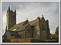
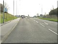
39 photos from this area
Area Information
Key information about the PR25 4XY including its size, population, and administrative classification.
- Area Type
- Postcode
- Area Size
- 2.4 hectares
- Population
- 1559
- Population Density
- 3976 people/km²
House Prices in PR25 4XY
44
Properties
£151,111
Average Sold Price
£46,000
Lowest Price
£240,000
Highest Price
Showing 44 properties
| Address | Type | Beds | Baths | Last Sale Price | Last Sale Date | |
|---|---|---|---|---|---|---|
| 128 St Davids Road, Leyland, PR25 4XY | Semi-detached | 3 | 1 | £193,000 | Nov 2025 | |
| 84 St Davids Road, Leyland, PR25 4XY | Detached | 3 | 2 | £240,000 | Oct 2025 | |
| 37 St Davids Road, Leyland, PR25 4XY | Bungalow | 2 | 2 | £165,000 | Sep 2025 | |
| 45 St Davids Road, Leyland, PR25 4XY | Semi-detached | 3 | 1 | £192,500 | Apr 2025 | |
| 140 St Davids Road, Leyland, PR25 4XY | Semi-detached | 3 | 1 | £206,000 | Nov 2024 | |
| 120 St Davids Road, Leyland, PR25 4XY | Semi-detached | 4 | 1 | £205,000 | Jun 2023 | |
| 112 St Davids Road, Leyland, PR25 4XY | Retail | 4 | 1 | £214,000 | Oct 2022 | |
| 114 St Davids Road, Leyland, PR25 4XY | Retail | 3 | 2 | £230,000 | Aug 2022 | |
| 118 St Davids Road, Leyland, PR25 4XY | Semi-detached | 4 | 1 | £220,000 | Apr 2022 | |
| 90 St Davids Road, Leyland, PR25 4XY | house | 3 | - | £195,000 | Feb 2022 |
Page 1 of 5
Energy Efficiency in PR25 4XY
Amenities
Schools
| Rank | School | Type | Entry gender | Ages |
|---|
Explore more schools in this area
Go to Schools tabDemographics
Household Size
One person
most common
Accommodation Type
Houses
most common
Tenure
83
majority
Ethnic Group
White
most common
Religion
N/A
most common
Household Composition
N/A
most common
Age
47
median
Adults (30-64 years)
most common
Household Deprivation
N/A
with no deprivation
NS-SEC
31
in Lower managerial occupations
Explore more demographic insights in this area
Go to Demographics tabPlanning
Planning Constraints
- Flood RiskPremium
- Ramsar Wetland SitesPremium
- Area of Outstanding Natural BeautyPremium
- Protected Nature ReservePremium
- Protected WoodlandPremium