Area Overview for PR25 1LA
Photos of PR25 1LA
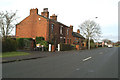
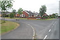
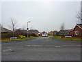
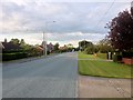
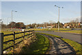
5 photos from this area
Area Information
Key information about the PR25 1LA including its size, population, and administrative classification.
- Area Type
- Postcode
- Area Size
- 5.7 hectares
- Population
- 1901
- Population Density
- 1158 people/km²
House Prices in PR25 1LA
45
Properties
£292,657
Average Sold Price
£53,500
Lowest Price
£675,000
Highest Price
Showing 45 properties
| Address | Type | Beds | Baths | Last Sale Price | Last Sale Date | |
|---|---|---|---|---|---|---|
| 499 Leyland Lane, Leyland, PR25 1LA | Detached | 4 | 2 | £485,000 | Sep 2025 | |
| 501 Leyland Lane, Leyland, PR25 1LA | Bungalow | - | - | £400,000 | May 2025 | |
| 568 Leyland Lane, Leyland, PR25 1LA | Detached | 4 | 2 | £675,000 | May 2025 | |
| 513 Leyland Lane, Leyland, PR25 1LA | house | - | - | £182,000 | May 2025 | |
| 515 Leyland Lane, Leyland, PR25 1LA | Terraced | 2 | 2 | £127,000 | Mar 2025 | |
| 537 Leyland Lane, Leyland, PR25 1LA | Bungalow | 4 | 2 | £415,000 | Aug 2024 | |
| 545 Leyland Lane, Leyland, PR25 1LA | Bungalow | 3 | 2 | £265,000 | Dec 2023 | |
| 562 Leyland Lane, Leyland, PR25 1LA | Detached | 4 | 1 | £420,000 | Dec 2023 | |
| 523 Leyland Lane, Leyland, PR25 1LA | house | - | - | £220,000 | Mar 2023 | |
| 532 Leyland Lane, Leyland, PR25 1LA | Bungalow | 4 | 3 | £460,000 | Dec 2022 |
Page 1 of 5
Energy Efficiency in PR25 1LA
Amenities
Schools
| Rank | School | Type | Entry gender | Ages |
|---|
Explore more schools in this area
Go to Schools tabDemographics
Household Size
One person
most common
Accommodation Type
Houses
most common
Tenure
51
majority
Ethnic Group
White
most common
Religion
N/A
most common
Household Composition
N/A
most common
Age
47
median
Adults (30-64 years)
most common
Household Deprivation
N/A
with no deprivation
NS-SEC
28
in Lower managerial occupations
Explore more demographic insights in this area
Go to Demographics tabPlanning
Planning Constraints
- Flood RiskPremium
- Ramsar Wetland SitesPremium
- Area of Outstanding Natural BeautyPremium
- Protected Nature ReservePremium
- Protected WoodlandPremium