Area Overview for PR2 8QY
Photos of PR2 8QY


Area Information
Living in PR2 8QY offers a defined residential experience within a cluster covering approximately 2.0 hectares. This specific postcode represents 1,696 residents, creating a settlement with a measured density of 84,058 people per square kilometre. You find a concentrated living environment rather than a sprawled suburb, which often means closer proximity to neighbours and shared local experiences. The area sits firmly in England, providing the familiar backdrop of UK town and village life. For a homebuyer, this size suggests a neighbourhood where daily commutes and local interactions happen within a compact footprint. You can expect a community where residents know each other, supported by a population that has settled here long enough to establish stable patterns. The small scale of the postcode means that services and facilities within easy reach are accessible without the need for extensive travel. This distinctively small footprint allows for a cohesive community feel, where the locality functions as a single unit rather than a disparate collection of streets. When you consider homes in this specific PR2 8QY zone, you are entering a space defined by its precision and manageable scale.
- Area Type
- Postcode
- Area Size
- 2.0 hectares
- Population
- 1696
- Population Density
- 2507 people/km²
The housing market in PR2 8QY is heavily skewed towards ownership, with 91% of residents owning their dwellings. Houses form the main type of accommodation, meaning the stock lacks high-rise flats or purpose-built rental blocks. This dominance of owner-occupied homes suggests that properties in this postcode have generally served as family residences or long-term homes over several generations. When buying homes in PR2 8QY, you are entering a market where vendors often plan to stay put, which can stabilise demand. The specific nature of the 2.0 hectare area limits the number of transactions compared to larger towns, but the high ownership rate indicates strong attachment to the location. You will not find the transient population typical of major city centre rental zones. Instead, the local economy likely supports professionals or semi-retirees who value the security of homeownership. The accumulation of house owners means that property maintenance usually meets higher standards, as owners have a direct financial incentive to keep their homes in good repair. The predominance of houses also influences local amenities, as shops often cater to family needs rather than those typical of dense urban living.
House Prices in PR2 8QY
No properties found in this postcode.
Energy Efficiency in PR2 8QY
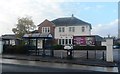
Daily life in PR2 8QY revolves around local convenience and named amenities that require minimal travel time. Residents can visit Morrisons Daily for groceries, M&S Royal Preston Hospital for health and retail needs, and Booths Fulwood for further shopping options. These five retail outlets provide a solid foundation for everyday shopping requirements. Commuters rely on the rail network for wider travel, with five railway stations within practical reach of the postcode. Preston Railway Station, Lostock Hall Railway Station, and Bamber Bridge Railway Station offer clear routes to other towns and cities. You can plan journeys with confidence, knowing that connections are close by. The presence of hospitals like the Royal Preston site suggests that essential services are nearby, adding to the sense of security and independence from the area. These amenities combine to create a self-contained lifestyle where most daily needs are met without needing to drive far. The specific names of the shops and stations ground the experience in reality, offering tangible options for your routine.
Amenities
Schools
Families living in PR2 8QY benefit from access to several educational institutions within a practical radius. Corpus Christi Catholic High School operates as a primary school with a good Ofsted rating. You also find Archbishop Temple Church of England High School nearby, which similarly holds a good Ofsted rating, providing a state-schooled option with recognised standards. For parents seeking independent education, St Pius X Preparatory School is available in the immediate vicinity. Additionally, St Thomas More High School stands as another primary option for local families. The presence of both state and independent schools means you can choose an education style that aligns with your values. The "Good" rating for the state schools indicates that the education provided meets the required benchmarks for quality teaching and student outcomes. This mix offers flexibility, whether you prefer the structured curriculum of the church-affiliated schools or the bespoke approach of the independent preparatory institution. All four schools listed serve the PR2 8QY community, ensuring that educational choices are integrated into the daily geography of the neighbourhood.
| Rank | School | Type | Entry gender | Ages |
|---|
Explore more schools in this area
Go to Schools tabDemographics
The community in PR2 8QY reflects a mature population, with a median age of 47 years. Adults between the ages of 30 and 64 constitute the most common age range, indicating that families with older children or those nearing retirement stages live here. You will find that 91% of residents own their homes, signalling a stable, settled area rather than a rental hub. Houses make up the predominant accommodation type, meaning you are looking at detached, semi-detached, or terraced properties typical of established English neighbourhoods. The area is primarily white in terms of ethnic group composition. This demographic profile suggests a quiet, established locality where long-term residents have invested in their properties. High home ownership often correlates with community engagement and stability, as landlords who lease to others frequently experience higher turnover than owners who stay for decades. For you, this translates into fewer disruptions and a predictable environment. The concentration of middle-aged adults also implies schools near PR2 8QY remain relevant for younger children, rather than the area being dominated by empty nesters or university students.
Household Size
Accommodation Type
Tenure
Ethnic Group
Religion
Household Composition
Age
Household Deprivation
NS-SEC
Explore more demographic insights in this area
Go to Demographics tabPlanning
Planning Constraints
- Flood RiskPremium
- Ramsar Wetland SitesPremium
- Area of Outstanding Natural BeautyPremium
- Protected Nature ReservePremium
- Protected WoodlandPremium