Area Overview for PR2 6EB
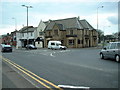
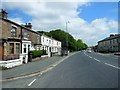
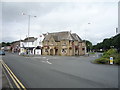
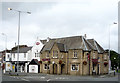
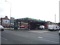
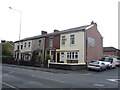
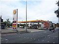
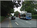
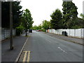
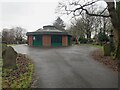
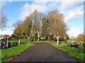
Photos of PR2 6EB
Area Information
Living in PR2 6EB offers a distinct experience within the Lancashire housing market. This specific postcode covers a small residential cluster that supports a population of 1689 residents. The area functions as a focused community where daily life revolves around established neighbourly bonds and straightforward accessibility to key services. Residents here enjoy the benefits of a compact layout, ensuring that essential amenities are within practical reach without the congestion of larger urban centres. The setting prioritises a quiet domestic rhythm, appealing to those who value stability over high-energy urban environments. Prospective buyers will find that living in this postcode means accessing a well-defined locality with clear boundaries and a cohesive identity. The environment is characterised by its residential nature, creating a space where household priorities align with traditional living needs. You can expect a setting where the focus remains on home life, supported by a network of nearby facilities that serve the immediate needs of the 1689 people calling this place home.
- Area Type
- Postcode
- Area Size
- Not available
- Population
- 1689
- Population Density
- 2750 people/km²
The property market for PR2 6EB is characterised by a strong presence of owner-occupied homes. With 76% of households owning their properties, this is clearly an estate of established residents rather than a transient rental zone. The accommodation type is principally houses, which aligns with the owner-occupied trend and suggests a market focused on family-sized properties or single-family dwellings. You will find that the housing stock here caters to buyers seeking permanent residences rather than short-term lets. This high level of ownership provides a stable environment where long-term planning is common amongst neighbours. For homebuyers considering this small area, the market dynamics reflect a community where purchase transactions are balanced by a lack of speculative activity. The prevalence of houses over apartments or terraced flats means the visual character is consistent and the buyer journey involves traditional property assessments typical of the UK market. This data confirms a neighbourhood where people stay put, making it a potentially desirable location for those seeking a settled home life.
House Prices in PR2 6EB
No properties found in this postcode.
Energy Efficiency in PR2 6EB
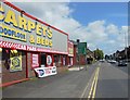
Your daily life in PR2 6EB is supported by a pragmatic array of amenities within easy reach. For shopping needs, you have five retail outlets nearby, including notable venues such as Morrisons Daily Preston 217, Heron Ribbleton, and Tesco Preston. These supermarkets and shops provide the essentials for household management without requiring a long drive. Transport links are equally accessible, with five railway stations counting among the nearest options. Preston Railway Station, Bamber Bridge Railway Station, and Lostock Hall Railway Station are all in your reach. This rail connectivity links you to wider travel networks efficiently. You can combine local shopping with potential train commutes to other parts of Lancashire or further afield. The presence of these specific retailers and stations means that lifestyle conveniences are integrated into the immediate surroundings of the postcode. Living here allows you to manage errands and travel with minimal effort, supported by identified service points that cater to resident needs.
Amenities
Schools
Parents considering a move to PR2 6EB will have access to a specific selection of educational institutions nearby. City of Preston High School serves as a primary school option for younger children in the vicinity. Families seeking alternative education paths can consider Woodlands School, which operates as an independent institution. For special educational needs, Sir Tom Finney Community High School is located close to the area. This mix provides a range of options for different educational requirements, from mainstream primary education to special needs provision. Having these schools near PR2 6EB ensures that families do not need to commute far for schooling. The presence of both state-funded and independent options gives residents choice when navigating the admissions process. While the list lacks secondary comprehensive schools or academies within this specific filter, the proximity of these three distinct facilities offers immediate support for young students living in the PR2 6EB postcode.
| Rank | School | Type | Entry gender | Ages |
|---|
Explore more schools in this area
Go to Schools tabDemographics
The community in PR2 6EB is defined by a relatively mature demographic profile. The median age stands at 47 years, reflecting a resident base that has settled into long-term homes. Most households fall into the adult age range between 30 and 64 years, suggesting a population of working-age adults and those entering retirement. Home ownership is a dominant feature of this neighbourhood, with 76% of residents owning their properties. This high rate indicates a stable community where families have invested in their local homes. The accommodation type is primarily houses, catering to established families and individuals seeking detached or semi-detached living arrangements. The predominant ethnic group is White, mirroring the broader demographic trends often found in established residential districts of Lancashire. This data paints a picture of a quiet, family-oriented enclave where property tenure is secure and the population is largely composed of adults who have put down roots in the area.
Household Size
Accommodation Type
Tenure
Ethnic Group
Religion
Household Composition
Age
Household Deprivation
NS-SEC
Explore more demographic insights in this area
Go to Demographics tabPlanning
Planning Constraints
- Flood RiskPremium
- Ramsar Wetland SitesPremium
- Area of Outstanding Natural BeautyPremium
- Protected Nature ReservePremium
- Protected WoodlandPremium