Area Overview for PR2 5TT
Photos of PR2 5TT
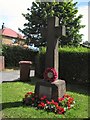
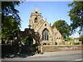
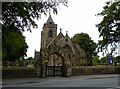
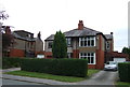
15 photos from this area
Area Information
Key information about the PR2 5TT including its size, population, and administrative classification.
- Area Type
- Postcode
- Area Size
- 6531 m²
- Population
- 2801
- Population Density
- 215 people/km²
House Prices in PR2 5TT
18
Properties
£286,067
Average Sold Price
£120,600
Lowest Price
£407,000
Highest Price
Showing 18 properties
| Address | Type | Beds | Baths | Last Sale Price | Last Sale Date | |
|---|---|---|---|---|---|---|
| 12 Wood Top Avenue, Preston, PR2 5TT | Detached | 4 | 2 | £365,000 | Sep 2023 | |
| 16 Wood Top Avenue, Preston, PR2 5TT | Retail | 4 | 2 | £288,950 | Nov 2022 | |
| 7 Wood Top Avenue, Preston, PR2 5TT | Retail | 2 | 1 | £140,000 | Nov 2022 | |
| 20 Wood Top Avenue, Preston, PR2 5TT | Detached | 5 | 3 | £407,000 | Oct 2022 | |
| 10 Wood Top Avenue, Preston, PR2 5TT | house | - | - | £369,950 | Dec 2019 | |
| 8 Wood Top Avenue, Preston, PR2 5TT | house | - | - | £364,950 | Jun 2019 | |
| 22 Wood Top Avenue, Preston, PR2 5TT | house | - | - | £364,950 | May 2019 | |
| 24 Wood Top Avenue, Preston, PR2 5TT | house | - | - | £324,950 | May 2019 | |
| 18 Wood Top Avenue, Preston, PR2 5TT | house | - | - | £384,950 | Aug 2018 | |
| 14 Wood Top Avenue, Preston, PR2 5TT | house | - | - | £259,950 | Feb 2018 |
Page 1 of 2
Energy Efficiency in PR2 5TT
Amenities
Schools
| Rank | School | Type | Entry gender | Ages |
|---|
Explore more schools in this area
Go to Schools tabDemographics
Household Size
Family (3-5 people)
most common
Accommodation Type
Houses
most common
Tenure
86
majority
Ethnic Group
White
most common
Religion
N/A
most common
Household Composition
N/A
most common
Age
47
median
Adults (30-64 years)
most common
Household Deprivation
N/A
with no deprivation
NS-SEC
43
in Lower managerial occupations
Explore more demographic insights in this area
Go to Demographics tabPlanning
Planning Constraints
- Flood RiskPremium
- Ramsar Wetland SitesPremium
- Area of Outstanding Natural BeautyPremium
- Protected Nature ReservePremium
- Protected WoodlandPremium