Area Overview for PR2 5SR
Photos of PR2 5SR

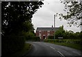

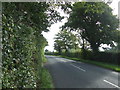

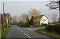
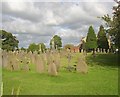

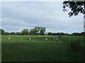
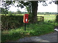
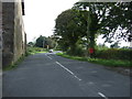

18 photos from this area
Area Information
Key information about the PR2 5SR including its size, population, and administrative classification.
- Area Type
- Postcode
- Area Size
- 1.2 km²
- Population
- 2801
- Population Density
- 215 people/km²
House Prices in PR2 5SR
12
Properties
£792,500
Average Sold Price
£540,000
Lowest Price
£1,000,000
Highest Price
Showing 12 properties
| Address | Type | Beds | Baths | Last Sale Price | Last Sale Date | |
|---|---|---|---|---|---|---|
| Lodgefield House, Haighton Green Lane, Preston, PR2 5SR | Land | - | - | £1,000,000 | Jan 2023 | |
| The Orchard, Haighton Green Lane, Preston, PR2 5SR | Detached | 6 | 3 | £805,000 | Nov 2022 | |
| Gregson House, Haighton Green Lane, Preston, PR2 5SR | Land | - | - | £825,000 | Jun 2021 | |
| Fern Cottage, Haighton Green Lane, Preston, PR2 5SR | Detached | 5 | 1 | £540,000 | Jul 2018 | |
| Haighton Top Farm, Haighton Green Lane, Preston, PR2 5SR | Detached | 3 | 2 | - | - | |
| Oak Leaf Cottage, Haighton Green Lane, Preston, PR2 5SR | Detached | - | - | - | - | |
| Primrose Farm, Haighton Green Lane, Preston, PR2 5SR | Detached | - | - | - | - | |
| Sea Mark Farm, Haighton Green Lane, Preston, PR2 5SR | Detached | - | - | - | - | |
| New Chingle Hall Farm, Haighton Green Lane, Preston, PR2 5SR | Detached | - | - | - | - | |
| Billingtons Farm, Haighton Green Lane, Preston, PR2 5SR | Detached | - | - | - | - |
Page 1 of 2
Energy Efficiency in PR2 5SR
Amenities
Schools
| Rank | School | Type | Entry gender | Ages |
|---|
Explore more schools in this area
Go to Schools tabDemographics
Household Size
Family (3-5 people)
most common
Accommodation Type
Houses
most common
Tenure
86
majority
Ethnic Group
White
most common
Religion
N/A
most common
Household Composition
N/A
most common
Age
47
median
Adults (30-64 years)
most common
Household Deprivation
N/A
with no deprivation
NS-SEC
43
in Lower managerial occupations
Explore more demographic insights in this area
Go to Demographics tabPlanning
Planning Constraints
- Flood RiskPremium
- Ramsar Wetland SitesPremium
- Area of Outstanding Natural BeautyPremium
- Protected Nature ReservePremium