Area Overview for PR2 4RQ
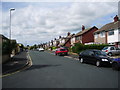
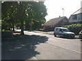
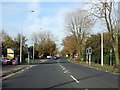
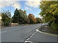
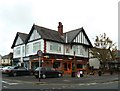
Photos of PR2 4RQ


Area Information
Living in PR2 4RQ offers a quiet residential experience within a defined cluster in England. This specific postcode covers a small residential cluster with a total population of 1,504 people. The area is established enough to have a clear identity while remaining relatively intimate. You will find a community where daily life revolves around stable housing stock and local connectivity. The setting is practical for those seeking a home based on ownership rather than renting. Residents of PR2 4RQ benefit from a mature environment where houses are the dominant accommodation type. The area functions well as a self-contained local neighbourhood. It provides a balanced setting for families and professionals who value stability. The low population density contributes to a calm atmosphere without sacrificing access to key services. You can expect a neighbourhood that prioritises established living over rapid change or development. The location serves those looking for a straightforward homebuying opportunity. The population size suggests a stable community without the transient feel of larger urban zones. Daily errands are manageable, and the neighbourhood maintains a distinct character separate from the wider city sprawl. PR2 4RQ represents a specific slice of real estate where ownership is the norm. You are purchasing into a settled market with a clear demographic profile. This cluster appeals to buyers who prefer a neighbourhood with a known population base rather than an expanding boundary.
- Area Type
- Postcode
- Area Size
- Not available
- Population
- 1504
- Population Density
- 4855 people/km²
Homes in PR2 4RQ are characterised by a market dominated by owner-occupiers. With 84% of households owning their homes, renting is a minority option in this area. This statistic defines the local property landscape as a space for long-term investment rather than short-term letting. The predominant accommodation type is houses, meaning you will find detached or semi-detached properties rather than flats within this postcode. For buyers considering PR2 4RQ, this environment means competition comes from other purchasers rather than tenant replacements. The market dynamics shift away from the transient cycles often seen in city centres. Stability is the key feature of the local housing stock. If you are looking to move into this area, you are entering a market where sellers have lived there for an extended period. This often results in properties that have been well-maintained over decades. The absence of rental dwellings as the primary stock simplifies the buying decision. You do not face a mixed-use scenario of owners and renters sharing the same immediate streets. Instead, the neighbourhood feels unified by the shared goal of home ownership. This makes PR2 4RQ an attractive option for those seeking to consolidate their assets. The local market reflects a preference for putting down roots. Builders and developers may find fewer opportunities, but existing homeowners have a clear advantage in maintaining their home's value.
House Prices in PR2 4RQ
No properties found in this postcode.
Energy Efficiency in PR2 4RQ
Life in PR2 4RQ is supported by a cluster of retail and transport amenities within practical reach. Five major retail outlets serve the immediate needs of residents. You can shop at M&S Royal Preston Hospital, Booths Fulwood, and Morrisons Daily. These locations cover essentials from groceries to general goods. The proximity of these stores means you do not need to travel far for weekly shopping. Transport links are equally convenient with four railway stations nearby. Preston Railway Station, Salwick Railway Station, and Lostock Hall Railway Station offer direct rail access. This network connects residents to wider city centres and regional hubs without significant waiting times. The availability of multiple stations gives you choices for different times of day or specific destinations. This infrastructure supports a balanced lifestyle where local convenience meets regional mobility. You can dine or run errands locally and then take a train for work or leisure. The mix of shops and stations creates a neighbourhood that feels both isolated and connected. Residents benefit from high-quality essentials without the noise of a high street. The amenities are functional and direct, catering to the household needs of the local population. This setup works well for those who value efficiency in their daily routine.
Amenities
Schools
| Rank | School | Type | Entry gender | Ages |
|---|
Explore more schools in this area
Go to Schools tabDemographics
The community in PR2 4RQ reflects a mature and established demographic profile. The median age stands at 47 years, indicating a population well-settled in adulthood. Most residents fall within the 30 to 64-year age range, which suggests a neighbourhood dominated by working-age adults and families. This profile aligns with the high level of home ownership, where 84% of households own their property. Such a high ownership rate signals a community rooted in long-term residence. You are looking at a demographic that has likely renovated or upgraded their existing homes. The accommodation type is exclusively houses, which reinforces the family-oriented nature of the population. There are no significant numbers of purpose-built rental flats or student housing within this specific cluster. Ethnically, the area is predominantly White, mirroring the broader patterns of many established English residential neighbourhoods. The combination of a high median age and strong home ownership creates a stable social fabric. Children and young adults are less common than adults, but the presence of the 30-64 group means there is still a working parent population. You can expect neighbours who have stayed put for years. This consistency supports local schools and community groups that rely on permanent residents. The population structure is not transient; it is built on sustained settlement.
Household Size
Accommodation Type
Tenure
Ethnic Group
Religion
Household Composition
Age
Household Deprivation
NS-SEC
Explore more demographic insights in this area
Go to Demographics tabPlanning
Planning Constraints
- Flood RiskPremium
- Ramsar Wetland SitesPremium
- Area of Outstanding Natural BeautyPremium
- Protected Nature ReservePremium
- Protected WoodlandPremium