Area Overview for PR2 3XY
Photos of PR2 3XY

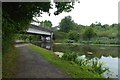
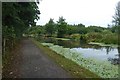
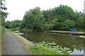
74 photos from this area
Area Information
Key information about the PR2 3XY including its size, population, and administrative classification.
- Area Type
- Postcode
- Area Size
- 7065 m²
- Population
- 1543
- Population Density
- 2748 people/km²
House Prices in PR2 3XY
29
Properties
£69,272
Average Sold Price
£29,500
Lowest Price
£95,000
Highest Price
Showing 29 properties
| Address | Type | Beds | Baths | Last Sale Price | Last Sale Date | |
|---|---|---|---|---|---|---|
| 18 Creswell Avenue, Preston, PR2 3XY | house | - | - | £95,000 | Mar 2021 | |
| 21 Creswell Avenue, Preston, PR2 3XY | Terraced | 2 | 1 | £66,000 | Sep 2019 | |
| 28 Creswell Avenue, Preston, PR2 3XY | house | 3 | - | £86,000 | Jun 2017 | |
| 20 Creswell Avenue, Preston, PR2 3XY | Terraced | 3 | - | £50,000 | Apr 2013 | |
| 37 Creswell Avenue, Preston, PR2 3XY | Terraced | - | - | £79,995 | Apr 2008 | |
| 26 Creswell Avenue, Preston, PR2 3XY | Terraced | 3 | 1 | £79,950 | Aug 2007 | |
| 36 Creswell Avenue, Preston, PR2 3XY | Terraced | 3 | 1 | £62,500 | Sep 2006 | |
| 24 Creswell Avenue, Preston, PR2 3XY | Terraced | 2 | 2 | £74,500 | May 2005 | |
| 16 Creswell Avenue, Preston, PR2 3XY | Terraced | - | - | £29,500 | Apr 2002 | |
| 42 Creswell Avenue, Preston, PR2 3XY | house | - | - | - | - |
Page 1 of 3
Energy Efficiency in PR2 3XY
Amenities
Schools
| Rank | School | Type | Entry gender | Ages |
|---|
Explore more schools in this area
Go to Schools tabDemographics
Household Size
One person
most common
Accommodation Type
Houses
most common
Tenure
40
majority
Ethnic Group
White
most common
Religion
N/A
most common
Household Composition
N/A
most common
Age
47
median
Adults (30-64 years)
most common
Household Deprivation
N/A
with no deprivation
NS-SEC
17
in Lower managerial occupations
Explore more demographic insights in this area
Go to Demographics tabPlanning
Planning Constraints
- Flood RiskPremium
- Ramsar Wetland SitesPremium
- Area of Outstanding Natural BeautyPremium
- Protected Nature ReservePremium
- Protected WoodlandPremium