Area Overview for PR2 3WE
Photos of PR2 3WE
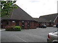
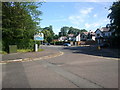
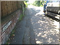

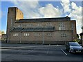
18 photos from this area
Area Information
Key information about the PR2 3WE including its size, population, and administrative classification.
- Area Type
- Postcode
- Area Size
- 2.0 hectares
- Population
- 1490
- Population Density
- 1105 people/km²
House Prices in PR2 3WE
20
Properties
£166,625
Average Sold Price
£65,500
Lowest Price
£325,000
Highest Price
Showing 20 properties
| Address | Type | Beds | Baths | Last Sale Price | Last Sale Date | |
|---|---|---|---|---|---|---|
| 5 Marston Moor, Preston, PR2 3WE | Semi-detached | 4 | 2 | £260,000 | Feb 2024 | |
| 24A Marston Moor, Preston, PR2 3WE | Detached | 4 | 4 | £325,000 | Sep 2018 | |
| 8 Marston Moor, Preston, PR2 3WE | Semi-detached | 3 | 1 | £176,000 | Nov 2015 | |
| 3 Marston Moor, Preston, PR2 3WE | Semi-detached | 4 | 1 | £175,000 | Jun 2015 | |
| 18 Marston Moor, Preston, PR2 3WE | Semi-detached | 4 | - | £195,000 | Mar 2015 | |
| 22 Marston Moor, Preston, PR2 3WE | Semi-detached | 4 | 2 | £186,000 | Apr 2013 | |
| 4 Marston Moor, Preston, PR2 3WE | Bungalow | - | - | £170,000 | Oct 2012 | |
| 16 Marston Moor, Preston, PR2 3WE | house | 4 | - | £159,000 | Feb 2012 | |
| 6 Marston Moor, Preston, PR2 3WE | Semi-detached | - | - | £101,000 | Apr 2002 | |
| 24 Marston Moor, Preston, PR2 3WE | Semi-detached | 4 | - | £87,000 | Feb 2001 |
Page 1 of 2
Energy Efficiency in PR2 3WE
Amenities
Schools
| Rank | School | Type | Entry gender | Ages |
|---|
Explore more schools in this area
Go to Schools tabDemographics
Household Size
Two person
most common
Accommodation Type
Houses
most common
Tenure
94
majority
Ethnic Group
White
most common
Religion
N/A
most common
Household Composition
N/A
most common
Age
47
median
Adults (30-64 years)
most common
Household Deprivation
N/A
with no deprivation
NS-SEC
52
in Lower managerial occupations
Explore more demographic insights in this area
Go to Demographics tabPlanning
Planning Constraints
- Flood RiskPremium
- Ramsar Wetland SitesPremium
- Area of Outstanding Natural BeautyPremium
- Protected Nature ReservePremium
- Protected WoodlandPremium