Area Overview for PR2 2RR
Photos of PR2 2RR

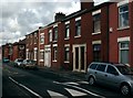

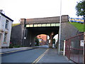
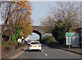

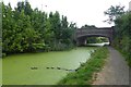
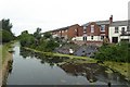
90 photos from this area
Area Information
Key information about the PR2 2RR including its size, population, and administrative classification.
- Area Type
- Postcode
- Area Size
- 4735 m²
- Population
- 1533
- Population Density
- 8419 people/km²
House Prices in PR2 2RR
29
Properties
£77,045
Average Sold Price
£34,000
Lowest Price
£130,000
Highest Price
Showing 29 properties
| Address | Type | Beds | Baths | Last Sale Price | Last Sale Date | |
|---|---|---|---|---|---|---|
| 29 Cannon Hill, Preston, PR2 2RR | Terraced | 2 | 1 | £125,000 | Jul 2025 | |
| 25 Cannon Hill, Preston, PR2 2RR | Terraced | 2 | 1 | £75,550 | Aug 2023 | |
| 3 Cannon Hill, Preston, PR2 2RR | house | - | - | £90,000 | Dec 2022 | |
| 23 Cannon Hill, Preston, PR2 2RR | Retail | 2 | 1 | £110,000 | Nov 2022 | |
| 40 Cannon Hill, Preston, PR2 2RR | Terraced | 2 | 1 | £77,000 | Feb 2022 | |
| 36 Cannon Hill, Preston, PR2 2RR | Terraced | 3 | 1 | £130,000 | Aug 2021 | |
| 20 Cannon Hill, Preston, PR2 2RR | Terraced | 2 | 1 | £70,000 | Sep 2019 | |
| 31 Cannon Hill, Preston, PR2 2RR | Terraced | 3 | 1 | £85,000 | Jan 2018 | |
| 27 Cannon Hill, Preston, PR2 2RR | house | - | - | £70,000 | Jan 2018 | |
| 11 Cannon Hill, Preston, PR2 2RR | Terraced | 2 | 1 | £58,000 | Feb 2017 |
Page 1 of 3
Energy Efficiency in PR2 2RR
Amenities
Schools
| Rank | School | Type | Entry gender | Ages |
|---|
Explore more schools in this area
Go to Schools tabDemographics
Household Size
One person
most common
Accommodation Type
Houses
most common
Tenure
45
majority
Ethnic Group
White
most common
Religion
N/A
most common
Household Composition
N/A
most common
Age
47
median
Adults (30-64 years)
most common
Household Deprivation
N/A
with no deprivation
NS-SEC
28
in Lower managerial occupations
Explore more demographic insights in this area
Go to Demographics tabPlanning
Planning Constraints
- Flood RiskPremium
- Ramsar Wetland SitesPremium
- Area of Outstanding Natural BeautyPremium
- Protected Nature ReservePremium
- Protected WoodlandPremium